wildlife

Your Guide to Visiting Badlands National Park, South Dakota

The Badlands. One of the most ominous sounding parks is also one of the most surprisingly beautiful. I’ve visited Badlands National Park twice, and I’ve been lucky (and unlucky) enough to experience every bit of its natural wonder. The Badlands are located in western South Dakota, and are made up of desert rock formations that resemble jagged peaks. This place can be both miserable and beautiful, and as one of the most unique places in the country, it deserves to be on your bucket list (during the winter perhaps).

Badlands1.JPG

Why are they called the Badlands?

Well, simply because of the terrain. The Lakota people called what is now Badlands National Park “mako sica” (“land bad”) due to extreme temperatures, jagged terrain, and the area’s lack of water. Personally, I can attest that these lands can indeed be very bad, but they can also be very beautiful. During my first visit, it was over 100 degrees Fahrenheit, but I was rewarded with the prettiest desert sunrise I’ve ever had.

Badlands10.JPG

The Basics

Badlands National Park is located within driving distance of two other amazing NPS sites: Wind Cave and Devils Tower (one of my personal faves). There is an entrance fee of $30 per vehicle, or the use of your America the Beautiful Pass. It is often incredibly hot in the park, and there aren’t a lot of places to fill up water. One of the best places to find clean drinking water is at the Ben Reifel Visitor Center near Interior, SD.

Badlands8.JPG

Can I bring my dog?

A common misconception is that dogs are not allowed inside National Parks at all—this is not true! The only thing is, Badlands isn’t the most dog friendly park due to the fact that it’s so hot much of the year, and dogs are not allowed on any of the trails. A good rule of thumb is that your dog is allowed anywhere your car can go. We hung out with Lassen for a bit at the picnic area near the visitor center, and for most of the day, he hung out in the van until we got back to camp where he got an extra long walk and a game of frisbee.

Badlands3.JPG

I’m a first time visitor… what should I do?

Badlands is about to majorly blow your mind! My ultimate first stop for you has to be Roberts Prairie Dog Town. It’s five miles down a dirt road on the Wall, SD side of the park, but it’s so worth it. You’re guaranteed to see prairie dogs, but also, where prairie dogs live, lots of other animals do too! We saw Pronghorns, Bison, and even a coyote stalking the Pronghorn herd!

Then, I’d drive down the scenic road. Stop at as many viewpoints as you want, but don’t skip the Yellow Mounds for some cool colors! Once you reach the visitor center, turn left, and head up to Notch Trail (the famous one with the giant ladder) for a hike you’ll always remember!

End your day with an incredible sunset, or wake up early the next day for sunrise (or both!).

Badlands9.JPG

What else should I know?

There is pretty good cell signal within the park, and gas stations less than ten miles outside the park on the Wall side.

Make sure you stay at least 100 yards from all wildlife, especially Bison, and watch for rattlesnakes when on the trails.

Badlands is a “free hike park.” This means that you can actually walk anywhere you want, even if there’s no trail. This is one of the only parks that’s like this, so have fun, but be careful. When I asked about this, the ranger I spoke to said, “Your only limitations here are gravity and wildlife.”

There are 3 options for staying in the park: the Cedar Pass Lodge, Cedar Pass Campground, and Sage Creek Campground. You can make reservations for Cedar Pass online. Sage Creek Campground is located in the backcountry but is accessible by car, and is free to stay at.

Pack out all trash! There are trash cans at many of the overlooks around the park. Please use them instead of leaving trash in the wilderness. If a trash can is full, please take your trash home with you.

Badlands7.JPG

The Badlands is an incredible park full of surprises. From wild animals of all types to vibrant colors, to views you won’t forget, the Badlands is a unique and simply underrated park.

To work the Badlands into an incredible road trip that reaches all 50 states, tap the button below!

Your Guide to Redwoods National and State Parks

With National Parks starting to open up again, I’ve been seeing quite a few questions about driving the California Coast. Not only is Redwoods National Park one of my favorite California National Parks, but its easily in my top two for spots to stop along the Coastal Highway. I’d even go as far as to say that it’s in my top ten National Parks I’ve visited so far, which is a lot to say, considering I’ve visited 35, some more than once.

Redwoods National and State Parks is a unique National Park. It’s what I would classify as a “small park,” a park with no true entrance station that is interspersed with towns, and state park land. The cool thing about this Park though is that it is so connected with the surrounding state parks. Some trails are run by the National Park Service, while some trails belong to the state parks. But don’t worry—the state parks here do accept the America The Beautiful Pass, one of the only places in the country to do so.

This is your complete guide to the park—it’s one of the more confusing ones to navigate! But don’t worry, you’ll be out and exploring as soon as you finish reading.

Disclaimer: This post may contain affiliate links

Somewhere along the Skunk Cabbage Trail, Redwoods National and State Parks, CA

Somewhere along the Skunk Cabbage Trail, Redwoods National and State Parks, CA

About the Natural Landscape:

Redwoods National and State Parks is home to the world’s tallest trees. A lot of people think that Sequoia is the place to go for towering trees, but the truth is, it’s here, right on the coast of California. This Park is easily one of the most biodiverse forests I’ve ever been in, second only to the Hoh Rainforest in Washington State.

Here, you’ll find two distinct landscapes: forest and rocky coast. Both are worth exploring while you’re there. In the area, you’ll also find plenty of freshwater lagoons and creeks to splash around in!

And if you’re short on time, don’t worry—so much of the park is just across the highway from something totally unique and different (and I’ll cover a day trip itinerary further down!).

Wildlife:

There is quite a bit of wildlife in the area, both small and large. Keep your eyes peeled for banana slugs on your hikes and whales in the coastal sections! But also make sure you’re mindful of larger land mammals too: elk, deer, bears, and mountain lions also live in the area.

Plants to watch for:

Of course, Redwoods is known for its plants, but there are a couple to watch out for on your hikes! Salmonberry trees have thorns that can hurt if they prick you, and cow parsnip lines many of the roads and trails. Cow Parsnip can cause burning and blisters, so it’s best to avoid it! The area is also home to poison oak, so long pants on longer, less developed hikes is key.

If you’re looking for ethical, adventure-inspired clothes to wear during your road trip, head over to The Wanderful Soul and use code HALLE for 15% off!

Along the Lady Bird Johnson Trail, Redwoods National and State Parks, CA

Along the Lady Bird Johnson Trail, Redwoods National and State Parks, CA

Know Before You Go:

As with all National Parks, there are a few things you should know before planning your trip to Redwoods. First, this is land owned both by the National Park Service and the California State Parks. This means that different areas have slightly different rules, but here are a few general guidelines you can follow:

Pets:

Dogs are always a bit tricky when it comes to National Parks. As a rule, in Redwoods NPS, dogs are not allowed on any park trails, but many of the beaches in the area are dog friendly, including those located in the state parks. Areas where pets are allowed include: Klamath River Overlook, Redwood Creek Overlook, developed campgrounds, Freshwater Beah, Gold Bluffs Beach, Crescent Beach, Cal Barrel Road, and Walker Road (dirt roads that can serve as good alternatives to trails with your pup!).

Entrance fees:

While the park itself is completely free to visit, there are areas that require a pass or fee to enter. These areas include Gold Bluffs Beach/Fern Canyon, which are part of Prairie Creek Redwoods State Park and Jedediah Smith Campground Day Use Area. Both are either $8 USD or the America the Beautiful Pass.

Skunk Cabbage Trail, Redwoods National and State Parks, CA

Skunk Cabbage Trail, Redwoods National and State Parks, CA

Visitor Centers:

There are a few visitor centers you can look for as resources for information when inside the park, especially since many areas in the park lack cell service.

If you are coming from the south, the Thomas H Kuchel Visitor Center might be best! It is located on the beach just off the 101 and only a mile South of Orick, CA.

If you are looking for a visitor center surrounded by cool trails, the Prairie Creek Visitor Center will be best. It is located along the Newton B Drury Scenic Parkway just north of Orick, CA.

If you are coming from the north, hit Hiouchi Visitor Center. It is the northernmost visitor center in the park, closest to Crescent City, CA.

Elk hanging out near the Prairie Creek Visitor Center

Elk hanging out near the Prairie Creek Visitor Center

Trails Worth Hiking:

Redwoods is a very hikable park and is a very accessible park to those who aren’t experienced hikers. There truly is a trail for everyone in the park, and there really aren’t any that are too steep, which makes this a fun park full of distance hikes, coastal trails, and short, scenic trails perfect for new hikers or families.

One of my favorite trails I’ve ever hiked (not just in the Redwoods, but in general) is the Coastal Trail Skunk Cabbage Section. This hike is about 7 miles round trip if you go all the way to the beach and it’ll take you through some of the most unique wilderness in the park. Here, you’ll find impressive plants: from Salmonberries, to the trail’s namesake, Skunk Cabbage, to the towering Redwoods themselves. You’ll also find a plethora of wildlife, from banana slugs to black bears. The trail peaks at a private beach perfect for having a relaxing lunch mid-hike.

Around the Prairie Creek Visitor Center, you’ll find miles and miles of trails. Have a ranger come up with a fun route for you that combines a few of the scenic trails or find your way using a trail map, which you can get at the Visitor Center. In this area, if you only have a couple hours, definitely don’t pass up the Big Tree. It’s only a mile and a half from the visitor center parking lot.

Along the Cathedral Trees Trail near the Prairie Creek Visitor Center

Along the Cathedral Trees Trail near the Prairie Creek Visitor Center

For families looking to get a short hike in, I’d recommend the Lady Bird Johnson Trail. It’s stunning, has a wide path, and will let you get up close an personal with some Redwoods without going off trail. This was honestly a highlight of my last trip to the Park.

For anyone looking for a fun adventure, head on over to Fern Canyon (this is one of the areas requiring a fee). This unique trail follows a creek through a long vertical canyon covered in ferns. Get ready to get your socks wet, and make sure you head to Gold Bluffs Beach after!

Up close and personal with some Redwoods on the Lady Bird Johnson Trail

Up close and personal with some Redwoods on the Lady Bird Johnson Trail

Where to camp:

There are four developed campgrounds in Redwoods National and State Parks. It is highly recommended that you make a reservation before heading to the park if you plan to frontcountry camp. You can camp in Jedediah Smith Campground, Mill Creek Campground, Elk Prairie Campground, and Gold Bluffs Beach Campground. There is also backcountry camping available with a free permit. Information about permits is available at the visitor centers.

What is there to do that doesn’t involve hiking?

There’s plenty to do in Redwoods National and State Park that doesn’t involve hitting the trails. See the Big Tree via the wayside rather than the trail, drive along the Newton B Drury Scenic Parkway, or view elk at the Prairie Creek Visitor Center.

If you want a relaxing day at the beach, head to Freshwater Beach or Gold Bluffs Beach. Look for tidepools at False Klamath Cove!

That being said, many of the trails in the park aren’t too difficult, so this might be a good place to get out of your comfort zone a bit!

Freshwater Beach, Redwoods National and State Parks, CA

Freshwater Beach, Redwoods National and State Parks, CA

I only have one day in the park, what should I see?

While you won’t have time to do everything, there are a few things I consider easy must-sees for Redwoods. Driving the Newton B Drury Scenic Parkway is an absolute must for anyone heading to the park for the first time. This is also a good opportunity to see the Big Tree and spot some elk near the Prairie Creek Visitor Center. Not too far from there is Gold Bluffs Beach, so that you can experience some of the coastal sections of the park. This beach is down a narrow and windy road, but I did it in my 17-foot long campervan! And while you’re there, you might as well hike Fern Canyon too!

If you’re heading South from there, don’t skip Lady Bird Johnson Trail, and if you’re heading north, the drive through Jedediah Smith State Park is gorgeous!

Planning your first trip to the outdoors? Check out my essentials at Madera Outdoor and use code HALLESWANDERINGSOUL for 20% off!

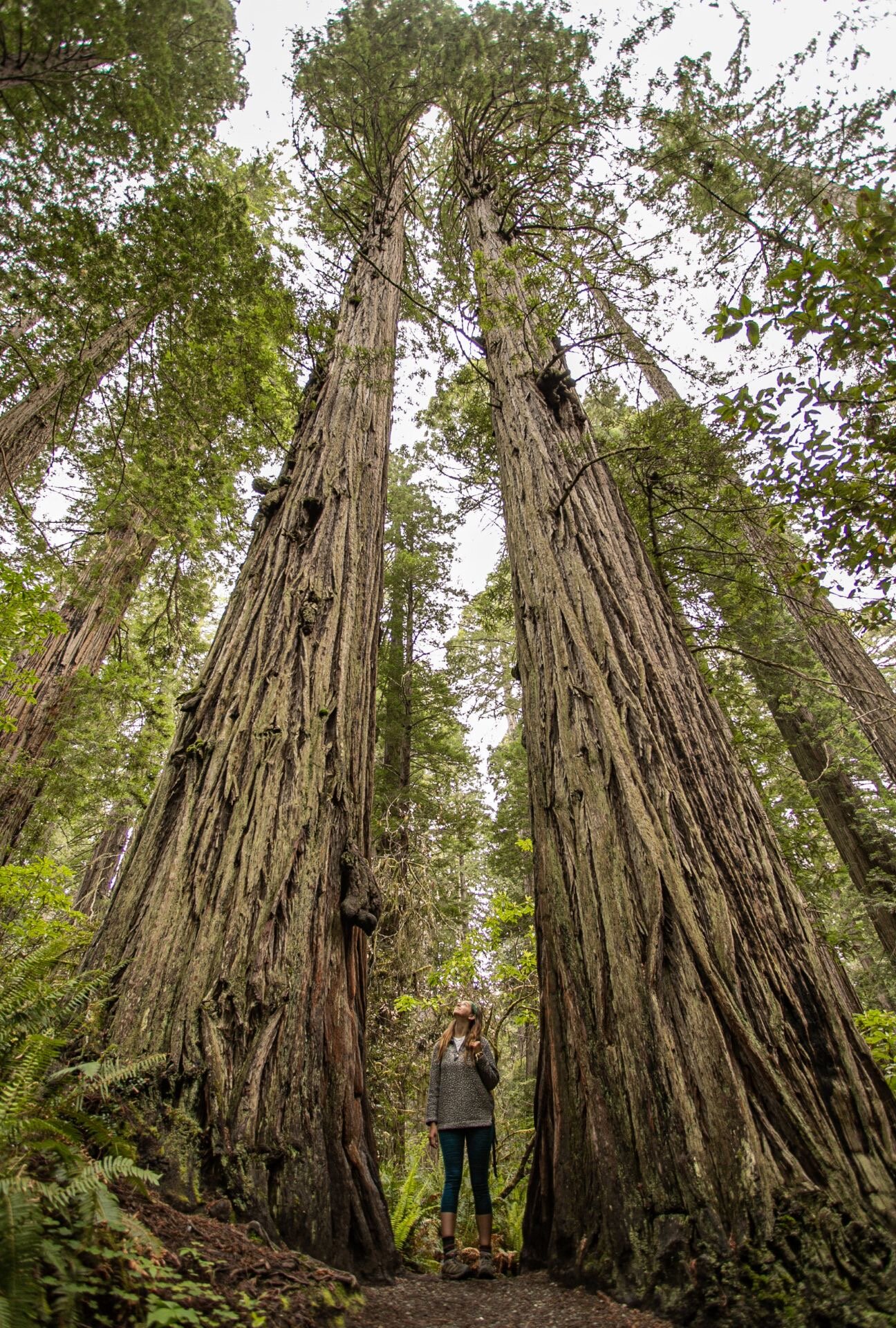
The trees in Redwoods are like nowhere else

The trees in Redwoods are like nowhere else

Redwoods National and State Parks is easily one of my favorite California National Parks. The gateway to the Pacific Northwest, it’s a must for anyone looking to drive up the coast this summer. So, strap on those hiking shoes, make sure you have plenty of gas in the car, and get ready for a wild coastal adventure!

Looking to plan a giant road trip that includes Redwoods National and State Parks? Check out my ebook in the shop to help you plan your very own 48 state road trip!

My Top 3 Wildlife Encounters From the Road

One of the most frequent questions I get about National Parks is “where can I see bears?” Wildlife is one of my favorite parts of travel, and in the US, where I’ve done the majority of my travels in the past couple years, there is so much wildlife to see, nearly everywhere you turn. From bison to bears, from bald eagles to seagulls, every landscape has its iconic animal residents, and I’ve encountered quite a few unique furry, feathered, and scaly friends over the years. These are my top three wildlife encounters, and where you can see some of the best!

Note: Please do not approach wildlife. Always leave 25 yards of distance between you and a wild animal, unless the animal approaches you. Even then, use caution.

Disclaimer: this post may include affiliate links

While not on this list, this one almost made the cut: a deer encounter on a trail in Voyageurs National Park

While not on this list, this one almost made the cut: a deer encounter on a trail in Voyageurs National Park

The Armadillos in Congaree

This is one of my favorite animal encounters I’ve ever had because A) armadillos won’t kill you (unless you lick them—they carry leprosy!) and B) I was with some little cousins of mine and they were completing their first Junior Ranger Program.

In Congaree National Park, South Carolina, there is tons of wildlife to be seen, from snakes, to spiders, to one lone and invasive crocodile. Even if you don’t want to do an extensive hike, you’ll see plenty of unique animals just outside the visitor center on the boardwalk trail. This trip was special because I was looking at everything on the boardwalk from a child’s perspective as I helped my cousins (about 9 and 4 years old) look for animals and plants to check off their Junior Ranger checklist. Toward the end of the boardwalk, we saw quite a few people gathered by the side of the trail, and to our surprise, we noticed 3 armadillos just waddling about! They had gotten really close to the boardwalk, so we were able to safely observe them without disturbing their territory (at Congaree, staying on the boardwalk is key!).

Learn more about Congaree and the other East Coast National Parks HERE!

Want to help animals? Shop ethical apparel and help give back to animal sanctuaries at Wholesome Culture and receive a special Halle’s Wandering Soul discount!

While I wasn’t able to get a picture of the Armadillos, here’s a great reason to visit Congaree. To see a video of them, though, head to my Congaree highlight on my Instagram

While I wasn’t able to get a picture of the Armadillos, here’s a great reason to visit Congaree. To see a video of them, though, head to my Congaree highlight on my Instagram

The Bison in Yellowstone

Yellowstone is ideal for wildlife viewing. Almost nobody visits the park without seeing a bison (or getting caught in a traffic jam—which I’ll explain in a minute). Yellowstone is home to wolves, elk, grizzly bears, bison, and so much more. It truly is the pinnacle of the old American West. If you’re looking to see some incredible wildlife, head out to the park’s Lamar Valley (and if you don’t want to make the trek, don’t worry, you’ll see plenty of animals during your trip).

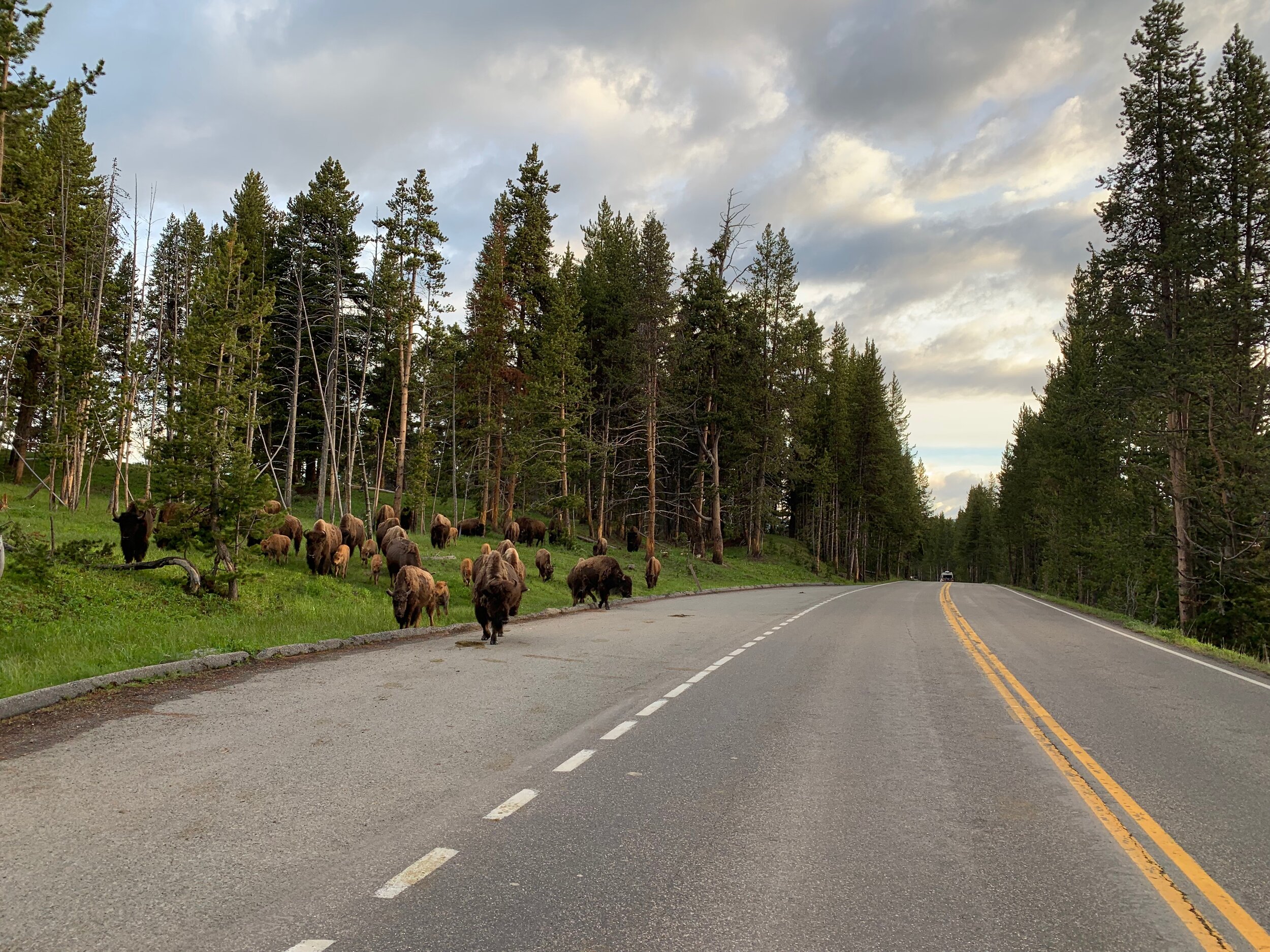
I only got to spend one night in the park, and stayed at Canyon Campground (which will forever remain one of my favorite campgrounds in the US). On my second day in the area, when I was going to head to Grand Teton National Park, I got up around 6 am, hoping to be on the road before the day’s tourists showed up. I stopped by Artists Point and Grand Canyon of the Yellowstone, and was greeted by one lone bison on the side of the road. This was a cool experience in itself, but I was surprised to turn the corner as I exited the canyon and find a herd of about 20 bison grazing near the road. I stopped to take a picture (from inside my car), and they proceeded to surround me in a classic Yellowstone traffic jam. Talk about morning rush hour! After about five minutes, they dispersed, and the entire time, I was the only one on the road.

Planning a camping trip? Shop environmentally friendly camping gear at Madera Outdoor and receive 20% off

The bison herd in Yellowstone

The bison herd in Yellowstone

The Bear in Yosemite

The other stories in this post are just cool, stunning interactions I had with animals, but this one is the reason I always try to tell tourists, “You don’t want to see a bear.” Yosemite is teeming with wildlife. It’s an incredible park full of towering cliffs and animals around every corner, but it’s important to remember that National Parks are not zoos or amusement parks—when we visit National Parks, we are in another creature’s home.

Yosemite is home to black bears. Black bears are slightly less dangerous than brown bears and grizzly bears, which you’ll find in the Rockies (I have seen two grizzlies though, but they were far away). Black bears are small, like the size of a large dog, but since I was visiting in November, they were on the hunt for food, as they were going to be hibernating soon. Because of this, a ranger came around to each site in Upper Pines campground, where I was staying, to tell us what to do if we did encounter a bear in the middle of the night. You’re supposed to say, “bear bear bear Bear Bear BEAR BEAR,” and keep getting louder to scare them off. Of course, you forget all of that when you’re actually faced with a bear.

It was about 10 degrees that night, and I lay in my dad’s old sleeping bag. I was new to tent camping still, and after this trip, I invested in my own 0 degree bag. After the ranger left, we had all gone through our tents and cars (Yosemite bears can break into cars), and since I had nothing in my tent that would smell like food, I felt fairly safe sleeping in active bear country with only a piece of fabric separating me from the outside world.

When camping in bear country, make sure that everything that smells like food is put away in your bear box, bear canister, or bear bag. You can also string your food up in a tree if backpacking. Some parks are less of a worry than others, and you can keep food in your car, but check with a ranger or camp host first.

Around 4 am, I woke up to snarling. Something huge was sniffing at our bear box, which I was camped maybe 10 feet from. I lay still, and quiet—the opposite of what you’re supposed to do, and I swear I remember hearing this bear walk right by me. Holding my breath, I just hoped she would go away, and after a few more seconds of sniffing at the bear box, she ran off into the woods.

It was dark, so I couldn’t snap a picture of the bear, but here’s a reason to visit Yosemite

It was dark, so I couldn’t snap a picture of the bear, but here’s a reason to visit Yosemite

Wildlife is simply one of the best parts about traveling in the national parks. Every state has such unique animals, and getting to know the nature of each spot is what makes everywhere so special. Check out some of my favorite spots for viewing wildlife below, and start planning your next road trip!

For bison: Badlands National Park, Theodore Roosevelt National Park, Yellowstone National Park, Grand Teton National Park

For bears: Shenandoah National Park, Yosemite National Park, Sequoia National Park, Glacier National Park

For deer: Glacier National Park, Shenandoah National Park, Voyageurs National Park

For lizards and snakes: Joshua Tree National Park, Grand Canyon National Park, Bryce Canyon National Park

For interesting insects: Joshua Tree National Park, Congaree National Park, Hot Springs National Park

For big horned sheep: Glacier National Park

For pronghorns: Badlands National Park, Bryce Canyon National Park

For mountain goats: Glacier National Park

For elk: Yellowstone National Park, Grand Canyon National Park, Redwoods National and State Park

For sea life: Olympic National Park, Redwoods National and State Park

If you’re interested in planning a giant trip around the country that includes most of the parks listed here, check out my ebook, Around the States in 90 Days in the SHOP!

A Complete Guide to Glacier National Park

Glacier National Park in Montana is truly one of those treasures that can’t be missed in the Lower 48. From its sprawling landscapes to its abundant wildlife, there’s nothing not to love about Glacier. It’s truly my favorite place in the entire contiguous United States. For people who haven’t visited, it often tops their National Parks bucket list, and for those who have been, it’s often a destination they’re trying desperately to revisit. Glacier National Park is a special place, and one that should be visited with care, to protect its rapidly changing natural landscape.

Because Glacier is such a large National Park, with multiple sections, I’ve found that it’s a bit intimidating to people who either haven’t been or who aren’t incredibly familiar with the National Parks System. This blog is here to answer your questions, and to be your essential guide as you plan your first trip to the park.

(Disclaimer: This post may contain affiliate links)

The view from the Logan’s Pass Visitor Center area

The view from the Logan’s Pass Visitor Center area

Know Before You Go

First, let’s cover the basics. Glacier National Park is located in northern Montana, on the Canadian border. You can cross into Canada from Glacier easily, to explore the Waterton Lakes area. Glacier is located in the center of multiple small towns, including Babb and Whitefish, and bordered on one side by National Forest. On the east side of the park, you’ll find the Blackfeet Indian Reservation of Montana. Due to the proximity of these towns and the preserve, it is important to enter the park with respect.

To enter Glacier National Park for one week, you will be charged a $35 entrance fee per car, or $25 in the winter, when the Going to the Sun Road is closed. I highly recommend investing in an America the Beautiful Pass or other interagency pass if you plan on visiting more than 3 National Parks in one year.

Dogs are allowed in the park, but are not allowed on most trails. They can visit the park in front country campgrounds, picnic areas, roads, parking areas, and in boats. Dogs must be on a leash no longer than 6 feet, and cannot visit the backcountry, lakeshores, or inside visitor centers. If a road is closed to vehicles due to winter weather, it is considered part of the backcountry.

Along the Hidden Lake Overlook Trail

Along the Hidden Lake Overlook Trail

Wildlife

Glacier is home to some of the most abundant wildlife in the country. This Park is largely wilderness, which makes it the ideal place to spot incredible animals, such as deer, black bears, grizzly bears, mountain goats, big horned sheep, and elk. It is also home to more elusive animals like pikas, bats, lynx, mountain lions, and wolverines. This truly is the ideal place to spot wildlife in their natural habitat, and I was lucky enough to see mountain goats, black bears, grizzlies, deer, and big horned sheep during my visit. It’s important to view wildlife here safely, though, and remember, wildlife is wild!

It is not recommended that you visit the park without someone in your party carrying bear spray, which can be purchased at the visitor centers, and any shops in the park. Bear spray is a one-time use deterrent equivalent to a large canister of pepper spray. It is to be used to defend yourself against a bear (usually a grizzly), in the case of danger. Do not spray a bear who is minding their own business, and do not use bear spray indoors or on a person.

Two deer in my site at Rising Sun Campground

Two deer in my site at Rising Sun Campground

When should I visit?

The only time of year you will be able to experience all of Glacier National Park is in the summer. During the winter, the main roads are closed. Keep in mind that winter in northern Montana can range between late September and late June, and no one knows when the Going to The Sun Road will open for the summer season—it all depends on weather.

The best and most popular month to visit is July, since there is still a considerable amount of snow on the mountains. However, I visited in late August, and there was still plenty of beauty to be seen!

Wildflowers blooming in late August in Glacier National Park, MT

Wildflowers blooming in late August in Glacier National Park, MT

Should I stay in East or West Glacier?

This is one of the most common questions when it comes to planning a trip to Glacier National Park. So, which is better? East or West Glacier?

Glacier National Park is divided into three sections, and two of those sections—East and West Glacier—are connected by the Going to the Sun Road, which I’ll cover later in this post. When it comes to which side to visit, my answer is: visit both, if possible! If not, due to weather or time, I would say East Glacier is home to most of what people picture when they picture visiting Glacier National Park.

St. Mary’s Lake in East Glacier

St. Mary’s Lake in East Glacier

West Glacier is largely forested, and won’t provide you with the views that East Glacier has. However, it is incredibly peaceful, and is a great place to stay if you’re looking for some quiet. It is also home to the only visitor center with legitimate cell service (Agpar Village), so if you need to call home, it might be worth making a stop here. As far as trails in West Glacier, they aren’t quite as impressive as the ones in East Glacier, but they are still worth checking out. The one that should definitely be on your list is Trail of the Cedars, a family friendly short trail that will allow you to get up close and personal with some of the Park’s largest flora.

East Glacier is home to many of the views people want to see during their trip, which is why I suggest heading here if you’re short on time. This is where you’ll find lakes, tall mountains, waterfalls, and views of the valley. You’ll also find a few more amenities in East Glacier, such as WiFi at the St. Mary’s Visitor Center, and a restaurant and motel at Rising Sun. This is also where you’ll find boat parking, and day parking for vehicles over 21 feet.

One of the many beautiful wooded views in West Glacier

One of the many beautiful wooded views in West Glacier

What is Many Glacier?

Many Glacier is the third section of the park, and truly one of the most spectacular. To access Many Glacier, you definitely need a car, as the park shuttle doesn’t go here. During 2020, the road to Many Glacier will be under construction, so be prepared for traffic and limited parking. There is also the option to hop on a boat from East Glacier, but this is not ideal for budget travelers.

You will have to show your entrance receipt or pass again when you enter Many Glacier.

Many Glacier is home to the Park’s main hotel, as well as some of the most famous sites in the park: Iceberg Lake and Grinnell Glacier. It’s important to remember that reaching these sites is not for everyone—you will be at elevation, and they are only accessed by trail.

Many Glacier is definitely one of my favorite sections of the park. It’s wild, largely untouched, and home to one of the last true glaciers in the continental US. This is also where I saw my first grizzly bears.

Grinnell Glacier, one of the most beautiful places in Many Glacier

Grinnell Glacier, one of the most beautiful places in Many Glacier

What is the Going to The Sun Road?

The Going to The Sun Road is one of the key parts of a full experience in Glacier National Park. This 50 mile long road will take you from East Glacier to West Glacier, and is only fully accessible to vehicles less than 21 feet long and park shuttles.

Driving this road is not for everyone. It is incredibly windy in the alpine section, and usually crowded. To beat crowds, I suggest hitting the road as early as 6 am. Here, you’ll find overlooks, pullouts, and three visitor centers with unique views and wildlife viewing opportunities. I suggest stopping at each exhibit, and making a whole day out of this unique drive.

My number one tip for experiencing the Going to The Sun Road is to take the shuttle, specifically if you plan on stopping in Logan Pass, the highest elevation on the road. There will not be parking at Logan Pass, as it is the most popular spot in the park, and the site of the High Line trailhead. If you do take the shuttle, when riding from Logan Pass to East Glacier, make sure you sit at a far-right window at least once—this is the best way to get views into the deep valleys below, but definitely isn’t for anyone afraid of heights!

The view from the Going to The Sun Road, heading East

The view from the Going to The Sun Road, heading East

There are also private tours of the Going to The Sun Road. If you would like a guided tour, check out the Red Bus Tours, which are not affiliated with the National Park Service.

Please keep in mind that the road is closed during the winter season, which can range anytime between September and late June, so it is best to plan a summer visit.

The view from the Going to The Sun Road heading West at 6am in late August: A Valley Filled With Clouds

The view from the Going to The Sun Road heading West at 6am in late August: A Valley Filled With Clouds

What can I see in the Park without hiking?

Glacier truly is a hiker’s paradise, but if you’re not a hiker, or aren’t physically able to do so, there is plenty you can still experience. The Going to The Sun Road is going to be your best bet for views comparable to those you might see on one of the Park’s longer hikes, and you can see Jackson Glacier from one of the first stops (coming from East Glacier). This is a great spot to stop and take pictures, but truly, any of the pullouts will do—Glacier’s views can’t be beat!

One of Glacier’s many waterfalls, as seen from a pullout along the Going to The Sun Road

One of Glacier’s many waterfalls, as seen from a pullout along the Going to The Sun Road

What are some family friendly hikes?

If you are traveling with kids, rest assured that there are plenty of hikes with good views that are ideal for families. While the park is a hiker’s paradise, there are quite a few trails that are short, or have little elevation gain (or both!). The first one I’d suggest checking out is the previously mentioned Trail of the Cedars in West Glacier. This magical spot is perfect for families with really young kids, as it does have a boardwalk, allowing those with strollers to experience these magnificent trees.

Another great family friendly hike in Glacier National Park is St. Mary’s Falls. These glacial waterfalls run bright blue, and the entire hike to see all three falls is less than 3 miles (out and back).

The first waterfall you’ll encounter along the St. Mary’s Falls Trail

The first waterfall you’ll encounter along the St. Mary’s Falls Trail

The last family friendly hike in Glacier that I’d highly recommend is a bit harder because it does gain some elevation, but the view is rewarding. At Logan Pass, you’ll find the Hidden Lake Overlook trailhead. This is the first section to a much longer hike (Hidden Lake), but this part is fairly easy for kids (I saw plenty on the trail). The trail is mostly made of man-made steps, and the peak will give you a spectacular view that can’t be beat. This is also where I saw my first ever mountain goats!

When traveling with kids, it’s important to give them the chance to learn and have fun. Pick up a Junior Ranger booklet at any visitor center, and help them earn a badge they can proudly wear throughout their trip.

View from the Hidden Lake Overlook Trail

View from the Hidden Lake Overlook Trail

Is visiting Logan Pass worth it?

Logan Pass is the highest point of elevation along the Going to The Sun Road, at over 6,000 feet. It truly is not something that should be skipped, and is key to having a full Glacier experience. Logan Pass is probably what I would consider the main visitor center, as it is exactly halfway between East and West Glacier. It is home to the Hidden Lake trailhead, as well as the High Line trailhead, and is integral to the shuttle system, as it is the only place you can transfer shuttles to get to West Glacier (the East Glacier shuttles are too large to go through the alpine section). Logan Pass is key to how the park runs, so make sure you don’t skip it!

In terms of that shuttle transfer, make sure you ask what time the last shuttles leave, and what time you should be back at Logan Pass to make it to East Glacier. The shuttles do stop running before sundown, and if you miss them, your only option will be to hitchhike back.

One of the many views near Logan Pass

One of the many views near Logan Pass

What hikes should be on my list?

If you are a hiker, Glacier is the ideal park for you. Apart from backcountry experiences, which you can read more about on the park website, there are two main hikes that you cannot miss during your trip to Glacier.

Disclaimer: please do not attempt without bear spray.

Located in Many Glacier, you’ll find the Grinnell Glacier trail. This 12.8 mile round trip hike will take you through some of the most beautiful landscapes in the park, under a small waterfall, and to one of the last standing glaciers in the continental US. This is a very difficult hike, and it’s recommended that you start early in the morning to find parking and beat the crowds. If you’re not sure of your ability, there are paid ranger-guided hikes that will take you up this trail and to the glacier. This is a hike to try and do as soon as possible. The glacier is melting fast, and will continue to do so due to global warming.

For eco-friendly (and glacier friendly) gear, products, and apparel, check out Madera Outdoor, Eco Roots, and Wholesome Culture, three companies here to make a difference.

Top of the Grinnell Glacier Trail

Top of the Grinnell Glacier Trail

The other must-hike trail in Glacier National Park is known as the High Line, which connects to The Loop. The High Line itself is a 16 mile out and back ridge hike that is not for the faint of heart—you will be on cliff edges for part of this hike! Most people connect the High Line to The Loop, a downhill trail that will make your trip an 11 mile one-way trip, rather than 16 miles out and back. The Loop, however, doesn’t have much to see, and will be 3 miles of steep downhill (so if you are prone to knee injuries, you might want to opt for the longer trip). The High Line is a spectacular hike with stunning views that will take you to a view of the other side of Grinnell Glacier. Here, you’ll see pine forests, towering mountains, and wildflowers. This is a very popular hike, and I would suggest heading out as early as possible. Since the trailhead is at Logan Pass, it is recommended that you take the first shuttle to the trail, rather than drive.

For either hike, make sure you have the right gear, including a rain layer.

One of the views you’ll catch on your way to Grinnell Glacier

One of the views you’ll catch on your way to Grinnell Glacier

Where should I stay?

There are tons of options when it comes to where to stay in Glacier National Park. One of the best ways to truly experience the park is to camp. While a few of the campgrounds to require reservations (Many Glacier, St. Mary’s, and Agpar), plenty are also available on a first come first served basis, and there are quite a few backcountry campgrounds available as well. On the west side, Avalanche is a good campground to stay in, due to its proximity to East Glacier. This is a great way to experience the West side of the Park at night, and have a shorter ride to the East side and Logan Pass during the day.

My favorite spot in Glacier is Rising Sun Campground. This campground is located in East Glacier, just 6 miles from the St. Mary’s Visitor Center. It is fantastic for solo travelers, and has its own shuttle stop. A stay at Rising Sun will also put you close to one of the park’s only restaurants, as well as a general store and pay showers. It’s also got one of the most unique sunrise views in the park, so make sure you get up early!

For camping in Glacier, I highly recommend using a 0 degree sleeping bag, no matter what time of year it is—it does get very cold at night. THIS is my favorite 0 degree bag, from Madera Outdoor.

There are also a few hotels and motels in the park, located at Rising Sun (East Glacier), Agpar Village (West Glacier), and Many Glacier. These are great options if you’re not into camping, or if it is simply too cold out to do so.

If you’d like to stay outside the park, there are options for that as well. On the West side of the park, you’ll find the town of Whitefish, Montana, an adorable little mountain town home to plenty of shops, restaurants, hotels, gas stations, and a hostel.

The sunrise in Rising Sun Campground

The sunrise in Rising Sun Campground

Glacier National Park is truly one of the treasures of the United States. No matter where you’re from, you should add it to your list, so that you too, can experience its incredible views, wildlife, and rapidly changing landscape. Glacier is unique, and is one of the largest and most popular National Parks in the United States, so let’s hit the road, and head out to the very north of Montana, to see what’s left of the United States’ true wilderness.

Where My Travel Bug Was Born

An Ode to Vasquez Rocks

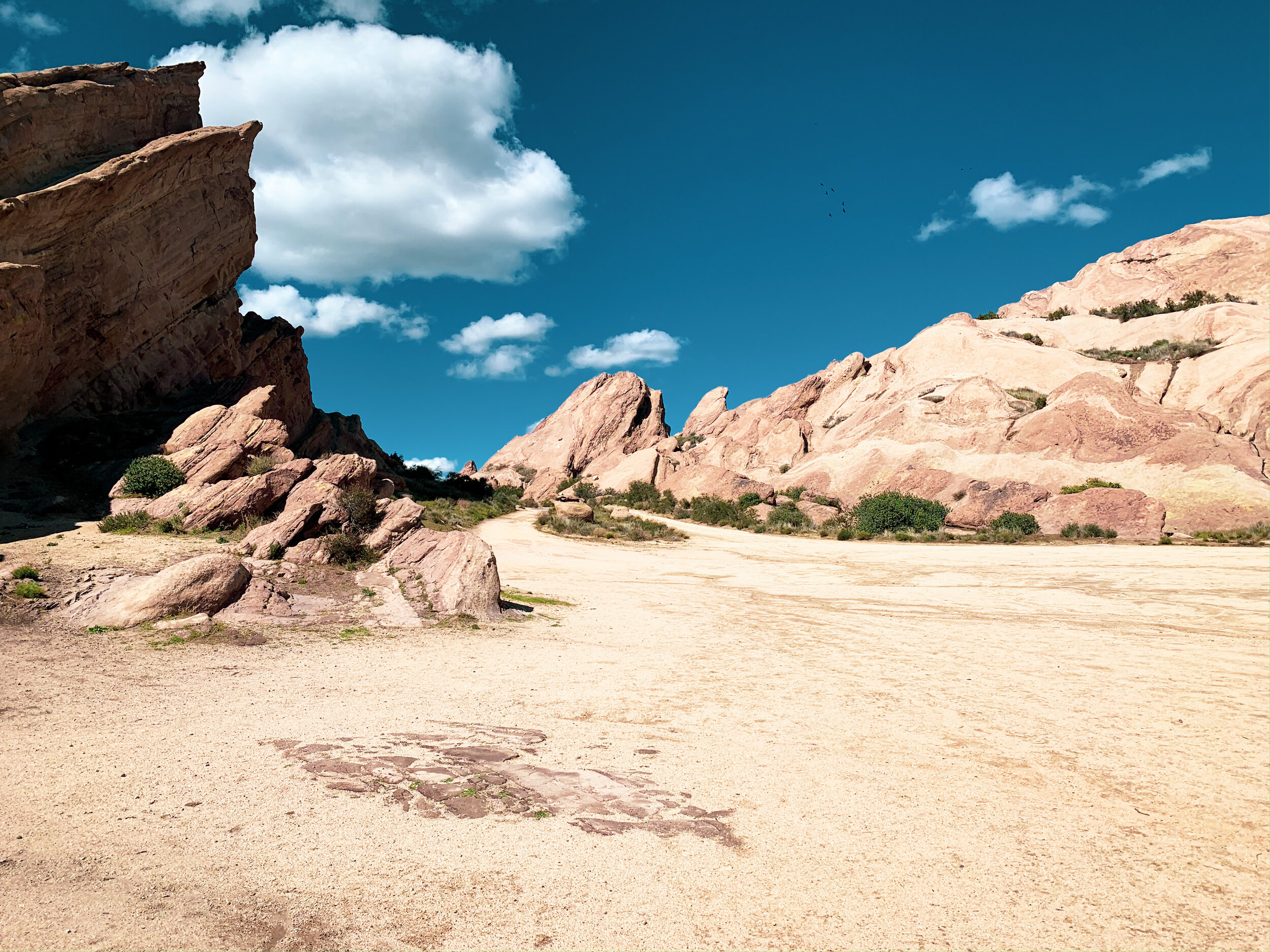
All travelers have to start somewhere. For me, it was in a county park that now feels so small, but holds so many memories. As soon as I was old enough, my parents started taking me to Vasquez Rocks County Park in Agua Dulce, California on a regular basis. My dad had come here as a kid as well, and if I have kids, and live in California, you can guarantee they’ll be climbing the same rocks.

My younger years at Vasquez were filled with nearly empty picnic spots, eating peanut butter sandwiches and tortilla chips on the rocks, and hunting for petroglyphs. Vasquez is a special place, and as much as it changes nearly every time I visit, the rocks are always the same, and the ravens still crow, and the tree we used to park next to still stands.

The Main Vasquez

The Main Vasquez

Vasquez Rocks is quite famous. You’ve likely seen its towering “main Vasquez” in commercials, or perhaps an episode of Star Trek, and the Pacific Crest Trail passes right through the park. But these aren’t the reasons it has a special place in my heart.

Vasquez Rocks for me represents the seeds of exploration. I associate its sandstone rock forms with my Peter Pan days of playing pretend and going on adventures that seemed big at the time. It was where I took my first hikes, scrambled my first rocks, and got my first few scraped knees. And now that I’m older, and the adventures have gotten bigger, I find myself reminiscing on those days more than ever, and have found myself returning to the park more often, making new memories.

Me as a young child, learning to rock scramble

Me as a young child, learning to rock scramble

I’ve since discovered new trails at Vasquez Rocks, and new parts of the park that I hadn’t paid much attention to as a kid. I found out that the park is dog friendly, and took my family’s dog, Josey there when we visited for my 21st birthday forever ago. Now, I’ve spent time studying the rocks with Jared (@jaredinthevan) as bouldering and climbing started to peak my interest.

The sandstone rocks of Vasquez

The sandstone rocks of Vasquez

We all have our safe spaces, and for me right now, those spaces are outside. It’s never a bad thing to revisit some childhood memories, either by physically going to the place, or through photographs (or both). Vasquez Rocks for me is a place that will always be there, no matter how much its changed over the years, and in times like these, it’s important to remember what made you the person you are today, to stay grounded, to not lose hope.

-HWS

My Must-Visit Spots in San Diego, CA

It’s no secret, if you’ve been following me a while, that cities aren’t really my thing. But when I was on my way back to my home base from my 3 weeks in Arizona, I really wanted to see where else I could fit into my route before taking a break from vanlife for a bit to get my WFA certification. A lot of my van fam had headed out to San Diego after Arizona, and it’s kinda the place to go for people in vans in the colder months because we, like birds, go south for the winter.

Now, it’s not that cities don’t have a ton to offer. There’s culture, food, and plenty to do. But there tends to be a bit more chaos in cities than I like. It’s a bit harder to park the van, and there are more rules about where you can sleep at night. I also tend to feel a little disconnected when I spent too much time in a city (truly, the forest is where I belong). But I went to San Diego anyway. So, for anyone in a van (or not!) who’s planning a trip to San Diego, these are my favorite places I went while I was there.

La Jolla Cove

La Jolla Cove

Sunset Cliffs and Ocean Beach

The beach towns tended to have a little more space for big ol’ Sequoia, so the first place I went was Ocean Beach. Sunset Cliffs is a natural park known for towering cliffs over the ocean. Lots of people come here to see the views, surf the waves, or watch the sunset because, well, it’s called Sunset Cliffs for a reason.

Ocean Beach is also home to a very cool nighttime farmer’s market on Wednesdays (starting at 4pm), where they have music, vendors, and tons of vegan food available.

Sunset Cliffs, Ocean Beach

Sunset Cliffs, Ocean Beach

La Jolla

La Jolla is one of the most crowded and complicated areas to visit if you have a van. Parking here is an absolute nightmare, and my one tip is to try to park as far from the actual coves as you can walk. I ended up finding parking over by the La Jolla Underwater Park (I believe), and walked the beautiful cliffside trail to the coves (which was only about a half mile and incredibly gorgeous).

La Jolla is one of the nicest areas I visited in San Diego. It’s full of touristy shops, expensive restaurants, and sea lions. Yes, sea lions. These gorgeous animals are what La Jolla is known for, so make sure you go to the coves and say hi (just don’t get too close! Remember to Leave No Trace!).

The sea lions of La Jolla

The sea lions of La Jolla

Mission Bay Park

This was a great little spot to go and relax, make lunch, and get some work done. It’s definitely not a place to plan on spending your entire day unless you have a kayak or paddleboard, but it did give me some beautiful views while I did some writing. A lot of people come here to walk or ride their bikes along the shore, get a work out in, or let their kids run off some steam. There’s also tons of parking during the day so if you’re looking for a place to just relax, hop on your hotspot, or take a walk, this spot should be on your list.

If you’re interested in pursuing the full time travel life and want to know the best way to make money online, check out Wired Creatives HERE!

Mission Bay Park

Mission Bay Park

Where I ate

I usually don’t talk about veganism on the blog, but honestly, a huge portion of what I do in cities is food related. Cities make it really easy to spend all your money on food. Luckily, because I have a kitchen, I did cook most of my food, and I had plenty of snacks with me, but there were a few points where I did buy food out. A favorite in Ocean Beach is Plant Power Fast Food. I used to work at one of their other locations, and it made for a super convenient place to grab a bite on the days when I was in OB. They also have WiFi, so it was a bit of a win-win.

I did also get an awesome meal at the OB farmer’s market on the Wednesday that I was there. They had tons of vegan spots at the event, but I found a vegan Chinese food place with no line that gave me an incredible amount of food for $12.

I also headed out to the University Heights area near SDSU where I went with a friend for dinner. We met at Plumeria Vegetarian Restaurant, a sit-down vegetarian Thai food place that was almost as good as the real deal.

The last place I ate out at was Loving Hut in Scripp’s Ranch. I wasn’t planning on heading out this way again, and then I found out that my childhood best friend was also in town, so I went out to where she grew up (and where I had visited with her mom a few days before), and she took me here. This place has amazing food and enormous portions. Would definitely recommend!

La Jolla Underwater Park, view from a coastal trail I parked near

La Jolla Underwater Park, view from a coastal trail I parked near

San Diego was an interesting first real city experience in the van. I did really enjoy my time there, despite the absolute chaos cities tend to bring. So, if you’re planning your own trip to Southern California anytime soon, make sure these spots are on your list—they’ll be sure to give you a pretty complete San Diego experience.

Three Must-Visit Spots in Laos

I recently returned from Southeast Asia, where I volunteered for a month in Thailand and Laos with GIVE Volunteers. It’s no question that, of the two countries, Laos made the bigger impact on me as a person, a traveler, and a global citizen. Laos is an incredibly special country, and the truth is, two years ago, like many of you, I had no idea it even existed.

Laos is a small, landlocked country just north of Thailand. It borders four other countries as well: China, Vietnam, Myanmar, and Cambodia. It’s known for its mountains, Buddhist culture, and waterfalls.

During our time in Laos, we visited three major spots (IE: one city, one backpacking village, and one remote village). This is the best journey through this beautiful country that will show you the best of Laos, from Luang Prabang to Sop Chem.

View from the Nam Ou River

View from the Nam Ou River

Luang Prabang City

Not to be confused with Luang Prabang Province, Luang Prabang City is the first part of Laos I got to experience. It’s a clean city with plenty of hostels (we stayed at Mao Pha Sohk Guesthouse), vans available as public transport, markets, and culture.

Luang Prabang is gorgeous, even for a city, and is home to a fantastic array of restaurants (Coconut Restaurant is a crowd favorite), as well as a huge night market that happens daily, starting at 5pm (Laos time). Our first day started with participating in the Alms ceremony, where we gave rice to monks as they made their way to temple. This is definitely something to experience, even though it starts at 5 am daily.

Another must-see in Luang Prabang is Tat Kuang Si National Park. This National Park is home to Kuang Si Falls, the famous waterfalls that are known as being one of the most beautiful places in the world, and the Free the Bears Moon Bear Sanctuary (who accept donations HERE). Both spots are incredibly important to witness for that perfect balance of cultural understanding and natural beauty.

The last must-see in Luang Prabang is the UXO museum. The UXO museum stands for the fact that Laos is the most bombed country and the most affected by the Vietnam War. Still, there is unexploded ordinance scattered throughout the country. True responsible tourism is understanding the culture, and there is no such thing as understanding Lao culture without talking about UXO.

View from Mao Pha Sohk Guesthouse at sunrise

View from Mao Pha Sohk Guesthouse at sunrise

Ban Sop Chem

Sop Chem is easily one of my favorite places on Earth. Sop Chem is a remote weaving village located directly on the Nam Ou River, and the best way to access it is by boat.

Sop Chem thrives on tourism. Most tourists just come for a day trip from Nong Kiaw, but there is a hostel in Sop Chem if you’d like to stay the night and experience this remote village for the night.

Here, we volunteered at the local school and permaculture plot, but also participated in plenty of cultural activities that tourists would also be able to experience, such as shopping for hand-woven fabrics, hiking to the Power China dam site, and exploring Tam Lom, a cave where the villagers of Sop Chem hid during the war (but please don’t go without a guide).

The people of Sop Chem are some of the most welcoming I’ve ever met, so stay a while if you can, pet the dogs, and play cards with the local kids—this is an experience like no other.

Ban Sop Chem

Ban Sop Chem

Nong Kiaw

Nong Kiaw was the backpacker village we stayed in on our way back to Luang Prabang from Sop Chem where we stayed in the Sunrise Hostel, and spent my birthday adventuring. There is so much nature to experience in Laos, and a lot of those beautiful places are right in Nong Kiaw.

Two of the most notable are the Pha Thok Cave and Pha Deang Peak hike. The Pha Thok Cave is another combination of nature and culture, as it gives you another perspective into the history of the country during wartime. Pha Deang Peak is a strenuous, approximately 6 mile hike that gains 3,000 feet in elevation from bottom to top. This is a genuine mountain summit hike, but it comes bearing some of the best views in the country.

View from Pha Deang Peak, Nong Kiaw

View from Pha Deang Peak, Nong Kiaw

Laos is truly one of the most beautiful places I’ve ever been. It’s known for village communities, mountains, and rivers, and the culture is like no other. I hear a lot of talk about visiting Southeast Asia, and Laos should be on everyone’s list, if not for the beauty, then for the culture.


Laos (other than Sop Chem, which is a good break from being on the grid) is incredibly backpacker and digital nomad friendly. Learn how to work and make money online with Wired Creatives HERE!

The Truth About Elephant Tourism

Elephant tourism is a hot topic in travel writing right now: what’s considered ethical, what’s not, and the distancing from elephant rides as a tourist attraction. But the problem is, a lot of what you’ll read about elephant tourism comes from the west, and it comes from people who haven’t experienced the truth behind the signs claiming that a sanctuary is ethical.

During my time in Thailand, I got the chance to speak with Eddie, a Mahout who’s worked with elephants his entire life in the remote jungles of Southeast Asia, and amongst all the funny questions the group had about what elephants eat or how often they poop, we got down to the nitty gritty about elephant tourism.

The truth is, even the remote jungles that Eddie works in with his elephant, are close to villages. The jungle sits adjacent to the village of Ba Kao Lam, where there is a school, and small farms that are attached to people’s homes. There isn’t really enough space for elephants left, because, let’s face it, elephants are enormous animals.

Me and Mai Boon Si in Ba Kao Lam, Thailand

Me and Mai Boon Si in Ba Kao Lam, Thailand

When people think about going to see elephants in Southeast Asia, their main requirement is that the sanctuary uses no chains. So many sanctuaries claim this, and keep their elephants out of chains to attract tourists, but the truth is, we don’t know what happens behind closed doors. We don’t know that these elephants are free roaming, and we have no way of knowing whether the elephants are chained up or kept in cages at night.

So, one of the first things I learned about how the Mahouts care for their elephants surprised me: they use chains for the safety of their elephants. Because their elephants are completely free roaming, they have the ability to walk an easy ten miles to the nearest village while the Mahouts are sleeping. Elephants are huge creatures, and this means they never, ever stop eating. When they reach a village, they have the tendency to decimate farms, eat a family’s supply of food, and destroy property. This puts them in more danger than they’re in in the wild—farmers can get angry and kill or injure the elephant before the Mahouts can track them to bring them back to safety in the jungles.

Feeding bananas to elephants in Ba Kao Lam, Thailand

Feeding bananas to elephants in Ba Kao Lam, Thailand

The chains these elephants wear are not tied to anything—they’re able to go wherever they want. But the chains do slow them down. This means that they likely won’t make it to the villages in a single night, which keeps them safe from people trying to protect their farms. The chains also help the Mahouts to track their elephants because they’re able to recognize the pattern the chain makes on the ground, which helps them to find the elephants quickly for health checks and feeding (elephants love bananas).

We had the chance to go trekking with the Mahouts for their elephants, and while it can normally take up to 3 hours to track them, we found them in 8 minutes, just across the stream. They seemed happy to see their Mahouts, as they each have a special bond with their animal, and were even more happy to see us because these 2 elephants—Mai Boon Yen and Mai Boon Si, two sisters and best friends—know that tour groups mean bananas.

We then trekked with the elephants down to the nearby river to give them a bath and feed them their favorite food, where the Mahouts did take off the chains, and I felt, even though I wasn’t sure about the chains at first, that this was truly the best way to make sure that they’re safe, and still kept wild.

Walking the elephants to the river for banana time

Walking the elephants to the river for banana time

So, the moral of the story is, you don’t know that what people tell you is ethical or the truth, and it’s truly best to learn from an expert before forming your own opinion. Give is not the only group that is able to trek with the Mahouts, so definitely look into finding a group to take you on a trek if you’re planning a trip to Thailand. It’s the only way to know for sure that the elephants are taken care of properly.

All the National Parks on the East Coast, Ranked

Okay, well not all of them. I haven’t been to the Florida National Parks, and I promised when I started this blog that I’d never write about a place on here that I haven’t personally been to. Instead, this is everything north of Florida. There aren’t a ton of National Parks on the East Coast of the United States, but there are definitely a lot of great qualities about the ones that do call these states home.

I’ve been to all of the National Parks along the East Coast that aren’t located in Florida, so I’m so excited to share my love for them with all of you. They’re all so unique. On the East Coast, we’ve got swamps. We’ve got mountains. We’ve got waterfalls. The East Coast is incredibly green, and is home to so much wildlife, from armadillos in the south to moose in the north.

This is every National Park on the East Coast (except Florida), ranked.

I do want to clarify that this list only contains NPS sites recognized as having Park status. There are so many more NPS sites on the East Coast that are also worth visiting.

Congaree National Park, SC

Congaree National Park, SC

6: Cuyahoga Valley, OH

I decided to throw two non-coastal states on this list because, let’s face it—there just aren’t a lot of National Parks on the East Coast. Most of the countries parks are out west, but that doesn’t mean these parks don’t deserve some love too! And Ohio and Kentucky are most certainly eastern states, so let’s get on with it.

I did really like Cuyahoga Valley, but it has to sit at #6 because it is a small park. There isn’t too much to do and it’s built within a neighborhood. That doesn’t mean it’s not absolutely gorgeous though! Cuyahoga Valley is amazing for waterfall chasing, and has a few good hiking trails as well! Don’t miss Brandywine Falls, and make the little trek out to Bridal Veil Falls—both are gorgeous!

Brandywine Falls, Cuyahoga Valley National Park, OH

Brandywine Falls, Cuyahoga Valley National Park, OH

5: Mammoth Cave, KY

This was super hard to put this low on the list because I genuinely loved my time in Mammoth Cave. Its campground was amazing (honestly up there with my favorite campgrounds, and it would’ve made this list if the list was longer), and the people were so nice. It was a nice cross between a small and big park (no entrance fee, but so much to do, and it’s all contained in itself). Mammoth Cave is the largest cave in the world, at over 600 miles long. The cave itself is awesome, but the park didn’t have a ton of hiking available to me because the ferry was closed when I was there, so I couldn’t access part of the park. Definitely get there early and book a cave tour. They don’t cost very much, and it’s spectacular. I wish I got to take a tour, but they were all sold out by the time I decided to do it. But honestly, Mammoth Cave is an absolutely gorgeous area—definitely add it to your list.

From inside the largest cave in the world, Mammoth Cave National Park, KY

From inside the largest cave in the world, Mammoth Cave National Park, KY

4: Congaree, SC

Okay, this feels like an unfairly low rank for this park because it’s actually one of the most unique places I’ve been. I promise this list keeps getting better! Congaree is genuine swampland. It’s home to tons of amazing insects and spiders, owls, armadillos, and even an invasive crocodile. It’s free to enter, but is also a contained park, so it had a similar vibe to Mammoth Cave. This is one of the most kid friendly parks I’ve been to, and I actually took my little cousins. We did the boardwalk loop, and they became junior rangers, which was so much fun, so definitely do that while you’re there (or in any park for that matter). Take this park in slowly. There’s so much to see that you’ll miss if you’re moving too fast.

The unique landscape of Congaree National Park, SC

The unique landscape of Congaree National Park, SC

3: Shenandoah, VA

Alright, so I genuinely love Shenandoah National Park. I had an absolutely beautiful, nearly spiritual experience here, and it’s such an absolutely gorgeous park full of so much wildlife (aka, my favorite thing about camping). I saw deer, bears, frogs, and even had a butterfly land on me for about 10 minutes. I met another empath here who taught me to listen to the forest. I had an entire campground to myself in the rain. But more than anything, this park has everything you could need. There’s showers and laundry available, gorgeous hikes, and super nice people.

I personally did two hikes in the park, and not the one I came to do. I originally planned on hiking Old Rag but it was going to be the hottest day of the year, so I opted for one that was closer to camp. My first day, I hiked Doyle River Falls, which has three waterfalls, some small creek crossings, and plenty of time to play and swim in the falls. It is super steep heading back though, so be ready for that incline! The second hike I did was Rip Rap, a ten mile loop trail with an ice cold, blue swimming hole in the middle. This hike is a must-do, but hike it backwards: downhill 7 miles first, swim, and then uphill for 3 miles!

Waterfall #3 of the Doyle River Falls hike, Shenandoah National Park, VA

Waterfall #3 of the Doyle River Falls hike, Shenandoah National Park, VA

2: Great Smoky Mountains, TN and NC

The Smokies are the most visited National Park in the country. They’re located across two states, Tennessee and North Carolina, and they’re so, so pretty. The Smokies get their name from the thick fog that rests on the mountains every day, and they’re a great place to see wildlife, and tons of biodiversity in the plants. It’s also worth driving part of the Blue Ridge Parkway if you get the chance. I hiked Charlie’s Bunion while I was there and it was so pretty, I made it my profile picture on basically every social media platform I use. The only reason this one is #2 instead of #1 on this list is because of the crowds. There are tons of people in the Smokies, so prepare for tourists, and hit the road early if you can! This park has free entry, but it’s definitely a big park, so give yourself time to drive through and see the sights!

This picture: me at Charlie’s Bunion, aka my profile pic everywhere. Great Smoky Mountains National Park, TN/NC

This picture: me at Charlie’s Bunion, aka my profile pic everywhere. Great Smoky Mountains National Park, TN/NC

1: Acadia, ME

Acadia was on my list of my favorite places I visited in 2019, so it’s only natural that it was #1 on this list. Acadia is the perfect mix of mountains and ocean: my two favorite landscapes on this planet. You’ve got pine trees, rocky cliffs, mountains to climb, and rocks to boulder. Acadia is located on an island, so there are plenty of opportunities to see the ocean. If you go in the summer, make sure you get there early in order to do famous attractions like Sand Beach, but if early isn’t exactly your speed, just show up and enjoy the ride (around the gorgeous loop road of course).

My favorite spot in Acadia National Park, ME. If you can find it, it’s yours.

My favorite spot in Acadia National Park, ME. If you can find it, it’s yours.

The East Coast is full of big cities and gorgeous landscapes. While there aren’t a lot of America’s Best Idea’s floating around back east, the ones that do call the East Coast their home are stunning, and definitely shouldn’t be missed.

To add these to a larger road trip, consider downloading my ebook: Around the States in 90 Days.

A Visitor's Guide to Olympic National Park

At the end of my 3 month solo road trip, I made a 3 day stop in Olympic National Park, Washington. The Pacific Northwest (PNW) will always have a special place in my heart. It’s the home of pine trees, mountains, and grey coastal shoreline. I first visited Washington as part of a day trip to Portland during the solar eclipse season of 2017, when I went up to Oregon for the very first time. This time, I came at Washington from the East, after visiting Glacier in Montana, and slowly made my way to Olympic about halfway through the week that I spent there.

Olympic is an incredibly unique National Park. It’s home to a vast array of different landscapes and ecosystems, and has a strange layout in terms of its road system. Olympic is known for its temperate rainforest, and is a favorite among backpackers and long distance hikers from all over.

This is my guide to Olympic National Park, and why you should add it to your bucket list.

Rialto Beach, Shore Section, Olympic National Park, WA

Rialto Beach, Shore Section, Olympic National Park, WA

Getting to Olympic

Olympic has a strange layout in that you cannot drive through the park, you can only drive around it. Of course, you can drive into certain sections, but you can’t drive straight through, so you have to be really cautious of where each entrance is. The good news is, as you drive the 101 around the park, you’ll pass through plenty of towns, such as the Twilight-famous town of Forks.

It’s important to know where the visitor centers are, and Google Maps will let you put in a specific visitor center when navigating to the park. Look for the Olympic National Park Visitor Center and Hurricane Ridge Visitor Center for information when you first enter the park. For extra information, the Hoh Rainforest Visitor Center is great but a little out of the way. You can also go to the Kaloch Ranger Station for help and the Wilderness Information Center for information regarding backcountry permits.

To enter certain parts of the park, such as Hurricane Ridge and the Hoh Rainforest, you will need to pay an entrance fee or show your interagency pass. It is $30 per car to enter, and your entrance fee at one section of the park will get you into the entire park for 7 days.

Lake Crescent, near Fairhomle Campground

Lake Crescent, near Fairhomle Campground

The different landscapes

Olympic has one of the most diverse ecosystems I’ve ever experienced in a National Park. They’ve got bears and banana slugs, beaches and rainforests. Every part of the park is something completely different, and it’s important to check out each of them. The following sections will bring you through each different ecosystem (and let you know which is my favorite!).

The Hoh Rainforest

“While there are multiple temperate rainforests in the United States, the Hoh is the only one you can drive your car into,” said a ranger at the Olympic National Park Visitor Center when I first arrived. I was immediately intrigued and set out to do my big hike through the rainforest on my second day in the park. The Hoh is known for backpackers, and has three trails. Two of them are small loops near the visitor center, but the Hoh River Trail is 17.3 miles long and is used for backpacking. You don’t have to have a permit to day hike on it though, so I went to Five Mile Island and back, making for a 10 mile hike.

The rainforest is home to lush greenery, crazy wildlife, like banana slugs and their darker, invasive species cousins, and tons of tourists. This is definitely the most popular part of the park, so plan accordingly! There is a campground in the Hoh too, just make sure you’ve got your rain fly if you’re tent camping.

Hoh River Trail, Hoh Rainforest, Olympic National Park, WA

Hoh River Trail, Hoh Rainforest, Olympic National Park, WA

Hurricane Ridge

It’s not Washington without mountains. Hurricane Ridge is the mountainous part of the park that is most easily accessible to visitors, as you can drive straight to it! It offers clear views of the park, but is pretty far from the rest of the attractions and is one of the few spots in the park that you need to pay an entrance fee for. Unfortunately, this is also one of the only parts of the park I didn’t get to explore, because it was Labor Day and the roads were too crowded for me to make the day trip.

You can camp at Hurricane Ridge, at Heart O’ the Hills Campground.

Lake Crescent

I recently talked about Lake Crescent in my Best Lakes of 2019 post, so I’ll make this short. Lake Crescent is known as one of the prettiest parts of the park. You can camp here at Fairholme Campground, which I did for 2 nights, and it was lovely. There is a nearby camp store with food, souvenirs, and other camping essentials like ice. The lake is open to boats, kayaks, SUPs, and other water recreation, and the area has plenty of hiking trails. I personally loved the Spruce Railroad Trail, which takes you through a really cool tunnel, and goes along the length of the lakeshore.

Be careful, though, this is the only part of the park that has poison ivy.

You’ll also be nearby Elwha and Sol Duc Valley when you stay near Lake Crescent and both are worth a little day trip (although Elwha is currently closed to cars).

Lake Crescent, Olympic National Park

Lake Crescent, Olympic National Park

Shore Section

All of this mountain and forest stuff is connected somehow, but on the other side of the highway you’ll find the shore section. The Olympic shoreline is easily my favorite part of Olympic National Park. It’s my Pacific Ocean that I grew up with, but it’s so different. There are pine trees overlooking the shore, and it’s full of rocky tidepools to explore.

Rialto Beach is my personal favorite, but you can also visit Kaloch and Ruby Beach and the coast near Lake Ozette. You can camp near the shore at Mora Campground (requiring reservations for 2020), and South Beach.

Rialto Beach, Olympic National Park, Shore Section

Rialto Beach, Olympic National Park, Shore Section

Truly, Olympic is the most diverse National Park I’ve been to. If you’re looking for a destination with beach, pine trees, mountains, lakes, and a little bit of rainforest (or a lot, depending on how far you hike), you won’t be disappointed with Olympic. So, make sure it’s on your list, and don’t miss the rest of the PNW while you’re at it.

If you’re interested in visiting Olympic and working it into a much larger road trip, check out my ebook: Around the States in 90 Days.