United States

A Complete Guide to Visiting the Grand Canyon

The Grand Canyon is among my favorite places on Earth. It was the site of my first ever solo trip, and will forever hold a special place in my heart. Located in Northern Arizona, the Grand Canyon is one of the Earth’s natural wonders, but it’s far more than just a hole in the ground.

At the bottom of the canyon is the Colorado River, flowing between the two main rims of the canyon. The Grand Canyon is home to a huge amount of wildlife, from elk to marmots to California condors, and it is the second most visited national park in the country.

I visited the Grand Canyon solo for three days during my last ever spring break. This was not only the perfect place for a solo trip due to the fact that it feels incredibly touristy and safe, but it was an absolutely beautiful place to visit alone. Being solo for this trip allowed me to really take it in, and this is a place you really have to be present for.

Being alone also allowed me to see most of the South Rim while I was there, which is the most popular section of the park to visit. This is your guide for planning your own trip.

Note: this post may contain affiliate links

View from the South Rim in March

View from the South Rim in March

So… there’s more than one rim?

Yes! The two main sections of the park are the North Rim and the South Rim. The South Rim is open year-round, and is located, well, further south, which means it’s a little warmer. The North Rim closes in the winter months and off season because it’s located at a higher elevation, and generally reopens in May. This elevation difference is so great, I’ve heard stories of people waking up to snow in the summer!

Most of this article will be about the South Rim, as it’s far easier to access for tourists.

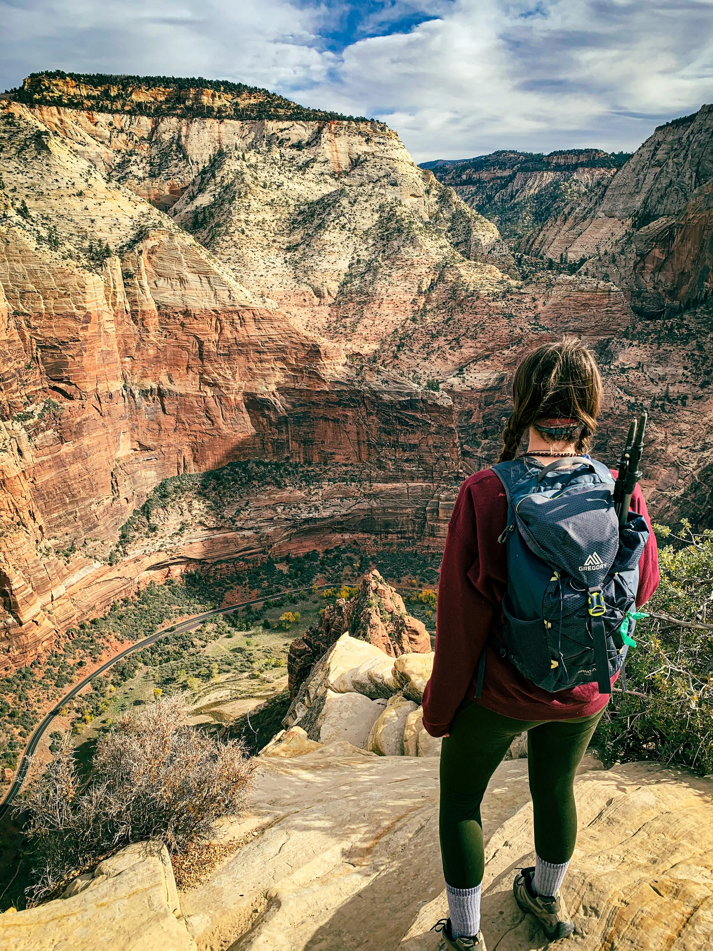
Canyon wall on the South Kaibab Trail

Canyon wall on the South Kaibab Trail

Getting to the park

The South Rim is incredibly easy to access. It has that classic “pay at the gate” type of entrance most large national parks have ($35 to enter, or America the Beautiful or other interagency pass). The closest town to the South Rim is Tusayan, and if you don’t want to drive, you can park your car in town and shuttle into the park (highly recommended during busy weeks, such as holidays and spring break).

I hear a lot of questions about visiting the Grand Canyon from Vegas, and I just want to put it in here that the South Rim is a 5 hour drive from Vegas. It is not super accessible. You can visit the West Rim, which is not part of the national park, and is home to the glass Grand Canyon skywalk. This is a cool thing to do, but it is not the national park, and will not give you that classic experience.

View as you approach Skeleton Point on the South Kaibab Trail

View as you approach Skeleton Point on the South Kaibab Trail

Staying in (or near) the park

I’m a traveler who prefers campgrounds, so when I visited, I stayed in Mather Campground because it was the only one of the two on the South Rim that was open in March (yes, March is still considered winter!). I reserved my site 3 months in advance (during that good ol’ government shutdown, remember that?), so I’d recommend booking a site as soon as you decide you want to camp in the park. Hopefully, you’ll be greeted by a herd of elk, like I was (which you can see in THIS VIDEO)—just make sure you give them their space! There is also a hotel in the park, and a second campground open during peak season (summer months) called Desert View.

There is also a campground in the North Rim if you choose to experience the northern side of the park. It is called North Rim Campground and is first come first served ONLY for 2020.

If you can’t book a spot in the park, no worries! Like I mentioned before, the town of Tusayan is an awesome place to stay because you can shuttle into the park from your hotel. The town of Williams is about a 45 minute drive from the park, which also has plenty of hotel and Airbnb options.

Marmot hanging out next to Skeleton Point

Marmot hanging out next to Skeleton Point

What is there to do?

I’ve heard tons of people say that they’ve gotten bored at the Grand Canyon, but the truth is, there is so much to see and do! If you’re not a hiker, there are plenty of sightseeing areas to explore.

You can walk part of the Rim Trail, which is a flat, 13 mile long stretch with views from the top of the South Rim. Most people only do a couple miles and stop at various viewpoints. A great place to start is behind the visitor center, at Mather Point (different from Mather Campground). Here, you’ll get some of the best views from the South Rim.

It’s also always useful to make a stop at the visitor center. This is where you can get all of your questions answered and explore the museum to learn more about the park. Here is also where you can find out information about various ranger programs.

Other great viewpoints work seeing are Yaki Point (known for being a great spot to view the sunset), and Yavapai Point (accessible from the Rim Trail).

It seems to just go on forever…

It seems to just go on forever…

I’m a hiker, where should I go?

The Grand Canyon is huge for hiking. While there are trails rated difficult on both rims, the most famous trails in the park are Bright Angel and South Kaibab (there is also the North Kaibab Trail on the North Rim). Both trails go to the bottom of the canyon, but you cannot go to the bottom without a backcountry permit.

The difference between the two is that Bright Angel is longer, but not as steep, which makes it the more popular of the two trails. South Kaibab is far steeper, but also far less crowded. I did a bit of Bright Angel on my first day in the park, but it was a bit too crowded for my liking. The next day I took the shuttle to South Kaibab (there is no parking lot—you have to shuttle), and it was far more enjoyable.

There are three stops before the river on the South Kaibab Trail: Ooh Ahh Point (great for families with kids), Cedar Ridge (perfect for moderate level hikers), and Skeleton Point (awesome for advanced day hikers). There is a similar set of rest stops along Bright Angel: Mile and a Half Rest House, Three Mile Rest House, and Indian Garden. Both big trails are out and back trails, and you will have to hike up the way you came, so bring water and plenty of food and plan accordingly.

Crazy rock formations out here

Crazy rock formations out here

Phantom Ranch and Havasupai

If you’re at all on Instagram, you’ve heard of Havasupai: the famous blue waterfall in the Grand Canyon. And if you’re into hiking, you might’ve heard about Phantom Ranch and Phantom Campground. Both spots require a backpacking permit to visit, and permits to Havasupai are growing more and more difficult to get (and cost $150 per night per person). Please do not attempt these hikes without proper training and a permit.

While we’re on the topic of backpacking, it is also possible to hike from the South Rim to the North Rim, but you also need a permit to accomplish this. If you do plan on backpacking, please make sure you have the right gear, and a cold weather sleeping bag made for backpacking.

View from Mather Point

View from Mather Point

Anything else?

Of course, there’s so much more to experience, but these are the most notable, and with this information under your belt, you’ll be more than prepared for a trip to GCNP. The most important thing is to respect wildlife. Especially when larger wildlife like elk are present, it’s necessary to keep the Leave No Trace principles in mind and stay 25 yards away!

But above all, have fun! If you’re camping, make sure you have the right gear and you’ll have the best time—camping in the Grand Canyon is one of my favorite camping experiences. Make sure you carry water, but also carry a camera: this park will not fail to blow you away.

Leave your questions about the park below! I’d love to hear from you!

A Quick Guide to Devils Tower National Monument

I’ve written about Devils Tower quite a few times now, so it’s clear that it’s one of my favorite spots in the continental United States. It’s also one of the most unique landscapes I’ve experienced, and is home to one of the most popular and challenging climbing spots in the country. Devils Tower was the first National Monument in the United States, and is located in Eastern Wyoming.

The tower itself is actually the remains of what used to be a volcano, and the area surrounding it is considered sacred by the Native American tribes in the area. When visiting, please respect prayer flags you might see hanging on trees and appreciate their unique beauty.

Devils Tower doesn’t just have cultural and geologic history, it’s also a huge piece of pop cultural history. Devils Tower was a major part of the set and story in Stephen Spielberg’s Close Encounters of the Third Kind, and because of that, many of the surrounding souvenir shops sell alien themed gifts.

Devils Tower is run by the National Park Service, but it is not a National Park. Despite the fact that it’s been a National Monument since 1906, it hasn’t received that legendary upgrade. A lot of people say that this is because the park itself is so small, but in my opinion, the tower itself is so magnificent, it deserves park status.

Note: this post may contain affiliate links

DevilsTower2.JPG

Preparing for your visit: things to know

Although Devils Tower is an incredibly small park, it’s absolutely magnificent. The road through the park is very short—only about 6 miles long from the entrance gate to the visitor center, and there is only one entrance. Regardless, the drive will take you past gorgeous red rocks, a prairie dog town, the park’s campground, and through gorgeous pine forests before you get up close and personal with the tower.

Entrance to the park is $25 or an interagency pass. You can either enter the park coming from Sundance or Hulett, but again, there is only one entrance, so it just depends on which direction you’re coming from. Hulett, which is about 10 miles from the park, has the closest gas station, but just outside the park, there are other services at the KOA (grocery and souvenirs), and the other souvenir shop across the street, which has WiFi. Having access to WiFi while I was there was a huge life saver for me, since I work online. This makes Devils Tower rank high for me in terms of accessibility to full time travelers. (If you’re trying to get on the road full time, or simply want to learn different ways to make money online, check out Wired Creatives HERE).

The visitor center will be your best friend while you’re here. The rangers are super helpful, and there is plenty of parking, including parking for larger vehicles and RV’s. The visitor center is the closest you can get to the tower without climbing it, and is the site of the Tower Loop Trail, a paved trail that I’ll get into more detail about in a couple sections.

DevilsTower1.JPG

Staying in or near the park

There really are only two options for a stay at Devil’s Tower. My personal preference is to stay in the park. I stayed at Belle Fourche Campground, which had amazing views of the tower from site A12, and cost $20 per night. The campground had picnic tables, flush toilets, and clean water for drinking. Plus, there’s the added safety of being inside the park, which is a huge plus when you’re a solo female traveler. The campground got strong AT&T service, which was also a plus because I didn’t have to go totally off the grid while I was there. If you stay in Belle Fourche, make sure you go to a ranger program or two—they’re super fun, and you can see climbers descending the tower at night from the amphitheater.

The other option is to stay at the KOA. Here, you’ll have more options for accommodations, from electric hookup sites for RV’s to little cabins if you’re not into camping. The KOA is much more expensive, and comes with a wider range of amenities.

Sunset over Devils Tower from my campsite in Belle Fourche Campground

Sunset over Devils Tower from my campsite in Belle Fourche Campground

Hiking Devils Tower

While Devils Tower is incredibly accessible to all kinds of tourists, you can easily see all of the easy-to-reach places in one day. These include seeing the prairie dog town, hitting the visitor center, and walking the Tower Loop Trail, a paved trail that circumnavigates the tower. Rock climbing is also popular here, but it’s not recommended unless you’re an advanced climber. You can also work the Tower Loop Trail into a much longer day hike, which I’ll get into in a second.

You can easily just do one of the few trails in the park, but none of the single trails are very long at all. Instead, since I’m an experienced hiker, it was recommended to me to do the “Devils Tower Marathon,” which connects all of the 8 miles of trails into one big hike. To do this, you’ll start by driving up a dirt road that’s near the visitor center to the Joyner Ridge Trail. From there, you’ll take a connector trail to the first half of the Red Beds Trail. From Red Beds, you can either cross the road and do the Valley View trail, which will take you near the prairie dog town. I opted out of this section because it was very overgrown and ticks and stinging nettles are a real thing. Instead, I just continued on the Red Beds Trail until I reached the visitor center, where I did the Tower Loop Trail before finishing the Red Beds Trail. Red Beds ends back at the connector trail, where you can go back and finish the Joyner Ridge Trail. This hike is between 6.5 and 8 miles total, depending on how many sections you complete.

View from the Red Beds Trail

View from the Red Beds Trail

Devils Tower is a unique experience everyone should have at least once in their life. It was an unexpected adventure for me, and I think it will forever be one of my favorite places in the country. From its cultural and pop cultural history, to its trails and wildlife, there’s so much to see here, and it should definitely be on your list for 2020, or any future year after that.

To add Devils Tower into a much longer US road trip, check out my ebook, Around the States in 90 Days.

A Guide to the Most Famous Mountain Ranges in the Continental US

It’s no secret that mountains are my favorite landscape. I’ve traveled the entire continental 48 and visited the most famous mountain ranges in the country (minus Alaska). For people who are new to the outdoors, learning the country’s geography can be confusing, especially because some of these mountain ranges are absolutely huge, stretching into Canada at times.

This is my quick guide to the four most famous mountain ranges in the US. You might’ve heard of them, and if you haven’t, you’ll be adding them to your list by the time you’re finished reading.

Note: this post may contain affiliate links

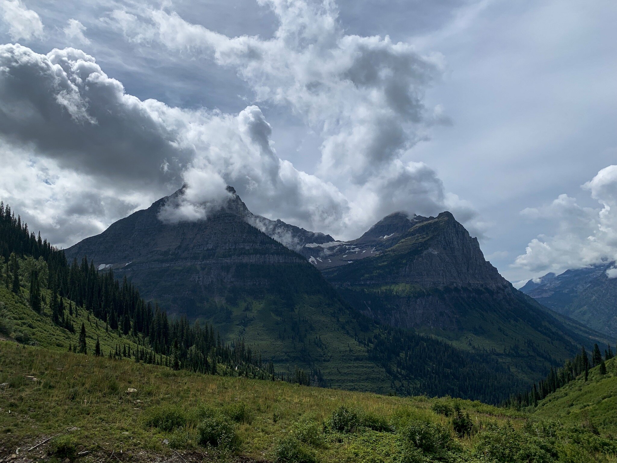
Glacier National Park, part of the Rocky Mountains, located in Montana

Glacier National Park, part of the Rocky Mountains, located in Montana

The Cascade Mountains

The Cascades is one of the bigger mountain ranges in the country, stretching from Northern California to British Columbia, Canada. Many of the western mountain ranges include volcanoes, and the Cascades are no exception. The Cascades are home to famous mountains such as Washington’s Mount Rainier and Oregon’s Mount Hood. The Cascades also include North Cascades National Park in northern Washington, a national park interspersed with forest land, and one of the most dog friendly parks in the country.

I love the Cascade Range. It’s full of incredible views and is located in what I would consider one of the best regions of the United States, the Pacific Northwest. It’s home to some of the most challenging, as well as some of the most beautiful hikes I’ve ever completed, and I definitely plan on returning in 2020. I highly suggest having some good gear for your time in the Cascades, and don’t attempt any hikes you don’t know for sure you’re prepared for.

North Cascades National Park, part of the Cascade Mountain Range, located in Washington

North Cascades National Park, part of the Cascade Mountain Range, located in Washington

The Sierra Nevadas

I’ve visited the Sierras a few times, during small trips to Sequoia and Kings Canyon National Parks, two national parks connected by a road through forest land, as well as larger trips to Yosemite. And no matter what time of year you visit, they’re absolutely beautiful, and are home to the tallest mountain in the continental 48: Mount Whitney, which stands at 14,505 feet tall.

The Sierra Nevadas stretch horizontally across the states, rather than vertically like the other ranges on this list, and lie between California’s Central Valley and the Great Basin in Nevada, although most of the mountain range is located in California. It includes both Sequoia and Kings Canyon National Parks, the Sequoia National Forest, the Inyo National Forest, Devils Postpile National Monument, and the famous Yosemite National Park.

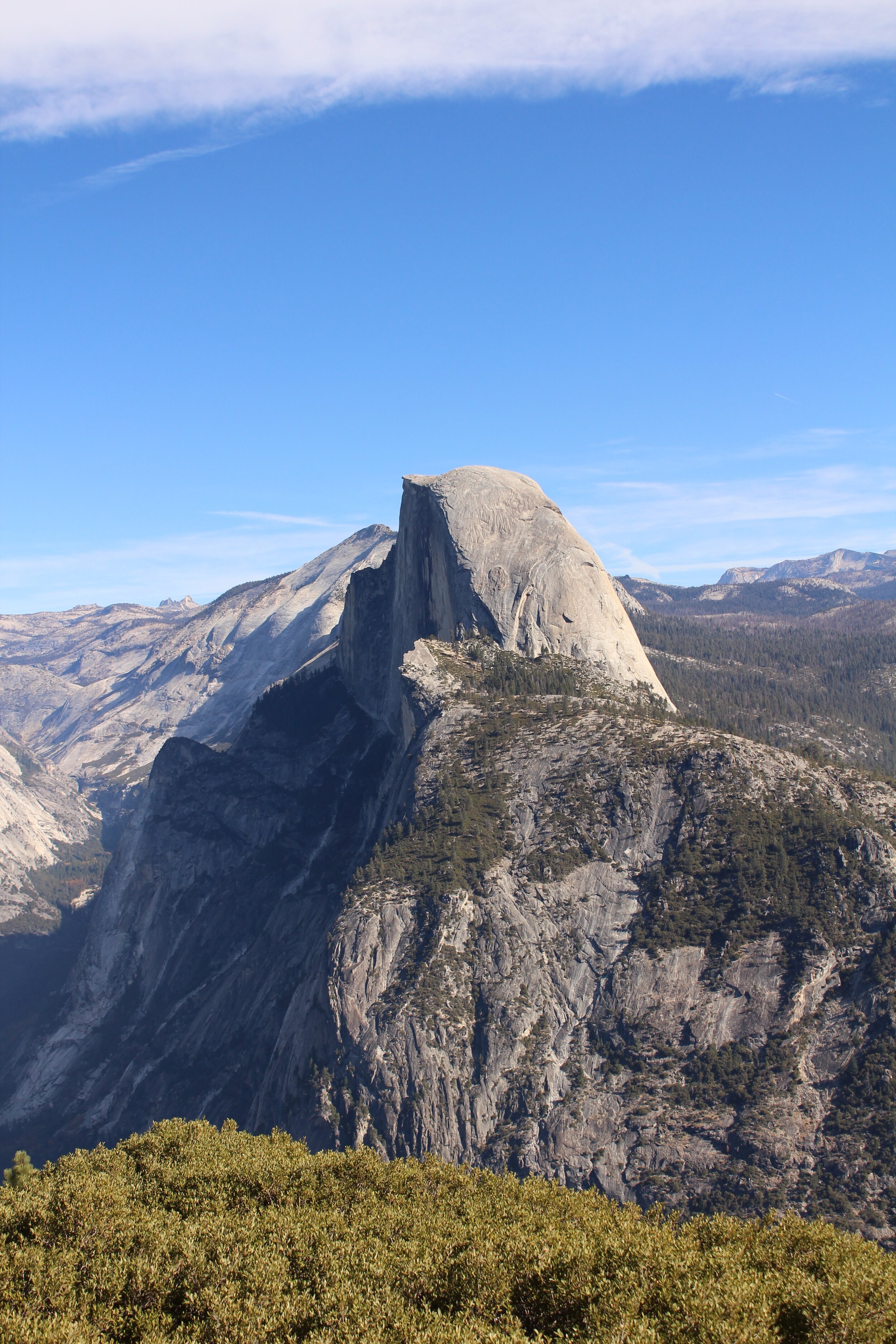
Half Dome in Yosemite National Park, part of the Sierra Nevadas, located in California

Half Dome in Yosemite National Park, part of the Sierra Nevadas, located in California

The Appalachian Mountains

The most famous mountain range east of the Mississippi, the Appalachian Mountains stretch across the eastern United States. The Appalachians are home to one of the most famous thu-hikes in the country: the Appalachian Trail, and include famous spots such as Great Smoky Mountains National Park (the most visited National Park in the country), and the Blue Ridge Mountains. While these mountains don’t quite reach the heights that the other ranges on this list do, they once did, but due to their age, have eroded. Now, the highest point in the Appalachians lies at only 6,683 feet.

The Appalachians are absolutely gorgeous. I’ve done some absolutely beautiful hiking there, in the Smokies and in Shenandoah National Park. While they aren’t as tall as my mountains out west, they’re often far greener than anything I’m used to seeing due to the amount of rain they get back east.

The Great Smoky Mountains, part of the Appalachian Mountains, located in Tennessee and North Carolina

The Great Smoky Mountains, part of the Appalachian Mountains, located in Tennessee and North Carolina

The Rockies

The Rocky Mountain Range is one of the largest mountain ranges in the area, stretching from Canada all the way to New Mexico. Of course, the most famous spot in the Rockies is Rocky Mountains National Park in Colorado, which is why we often refer to the part of the Rockies located in the states as the “Colorado Rockies.” You’ll be surprised to find out, though, that some of the other famous mountains in the middle of the country are actually part of the Rockies as well, including the Grand Tetons and Glacier National Park.

The Rockies are home to some of the biggest and most beautiful mountains I’ve ever seen. Most parts of them are extremely cold due to their elevation, the tallest mountain in the range being Mount Elbert in Colorado, standing at 14,440 feet. Apart from tall mountains, I’ve seen some of the most incredible wildlife in the Rockies, from mountain goats, grizzly bears, and big horned sheep in Glacier to elk and deer in Colorado’s Rocky Mountains National Park.

(When hiking in these areas, please carry bear spray, especially if you’re hiking solo. I never once felt that I was in danger, but it’s always good to be prepared for anything.)

The Grand Tetons, part of the Rocky Mountains, located in Wyoming

The Grand Tetons, part of the Rocky Mountains, located in Wyoming

Of course, there are plenty of other, smaller mountain ranges in the country, and a few I haven’t explored yet, up in Alaska, but if you’re starting to plan your trip around the US, these are four sections of the country you definitely can’t pass up, especially if you’re a hiker, camper, or general lover of the outdoors. These mountains have left a mark on me as a traveler, and I can’t wait to return to them in the future.

Which one is on the top of your 2020 bucket list? Let me know in the comments!


If you’re planning a 2020 (or whenever!) trip around the US and want to include all four of these beautiful places, my ebook, Around the States in 90 Days will be a great resource for you. Check it out in the shop!

How My First Trip in the Van Really Went

An Anecdote From A Full Time Solo Traveler

On December 11, 2019, I set out toward the desert in my new (to me) campervan. I bought the van in October, following my 48 state, 3 month, solo journey. This journey changed me, and inspired me to keep going, traveling by road full time.

National Parks are safe and sacred places to me, and Joshua Tree is the park I know the best of the 33 I’ve visited in my young life. It’s only 3 hours from my hometown, so it made sense, in the beginnings of winter, to head there, instead of my van’s namesake, Sequoia.

I had to do a test run before I headed off on a plane to Southeast Asia for the rest of the winter, because upon returning home in mid-January, I’d be hitting the road for good almost immediately.

Sequoia on the BLM

Sequoia on the BLM

This was my first stay on BLM land. BLM land is free to camp on, and is run separately from Forest Land and Park Land by the Bureau of Land Management. Joshua Tree has BLM located at the south entrance, near the Cottonwood Springs visitor center (one of the only places with flush toilets in the park, for those of you who are planning a trip out there).

My experience on the BLM was amazing. There are tons of designated spots there, it’s free to camp, and you get a fire pit. There are no toilets, so I was more than thankful to have the toilet in my van. I didn’t have my propane for my van stove yet, so I broke out the old camp stove that traveled with me all over the country, and made lunch with a view of my California desert mountains in the distance. My first day consisted of yoga, filming a van tour for my YouTube channel, and, once the sun went down, catching up on all my friends’ videos I’d missed out on while I was working.

My view of the BLM land, facing the park

My view of the BLM land, facing the park

It was a chilly night, but with three blankets and my windows covered in reflectix, I was plenty warm, and woke up to the sun peeking out over the mountains and through a crack in the window covers.

The real adventure would start just a couple hours later. I made breakfast, I got dressed, I got everything all ready to go, and then… the van wouldn’t start. It wouldn’t even turn over. And the oil light was on. I was calm about it, I’d run into issues on the road over the summer (like locking my keys in the car), so I know that there wasn’t a universe where this didn’t work out. My first instinct is always to ask my neighbors. Only one family was awake, and they didn’t have oil, which was obviously the problem, so my next response was to call AAA.

Cholla Cactus on Ryan Mountain

Cholla Cactus on Ryan Mountain

The first lady I got on the phone was incredibly nice, made sure that all I needed was oil, and told me to hang tight until a dispatcher would call with an arrival time. It wasn’t until he called me that any of this became a problem. My whole day came crashing down with one sentence: “We don’t bring oil.”

I was frustrated at this point because the first person had made it sound like getting me oil wouldn’t be a problem. So, he told me he’d talk to his supervisor and call me back. When 20 minutes had gone by without a phone call, I hopped back on the phone with AAA, and did exactly what every millennial bone in my body didn’t want to do: asked to speak to a manager.

After about 20 minutes more of back and forth with her, explaining that I couldn’t pay for a tow (which is also, not actually complimentary), and that I was alone in the desert, she paused, and said, “let me see what I can do.” I was put on hold, and eventually, when she got back on the phone she asked what kind of oil I needed. By some miracle of the universe, her dispatcher in Indio had decided to make an exception for me, and would be bringing me oil as long as I could reimburse him.

Road through Joshua Tree, near the Yucca Valley entrance

Road through Joshua Tree, near the Yucca Valley entrance

Long story short, he showed up, and I was still able to make it into the park to hike Ryan Mountain. But the moral of the story is, carry extra everything if you have an older vehicle. I don’t know how I got so lucky to get on the phone with such nice people in the end, but it’s something my other overlanders out there should be aware of.

The first night was amazing, the next day could’ve been a disaster. But it wasn’t, because everything works out the way it’s meant to work out, and I was able to drive through the park still, and feel a little bit at home again.


For more about this little vanlife breakdown, I will be coming out with a video of the whole thing, plus a bit of a guide to Joshua Tree in a couple weeks on the Halle’s Wandering Soul YouTube channel. Make sure you subscribe and turn on notifications so you never miss a video!

The Prettiest Lakes I Visited in 2019

I’ve seen a lot of lakes in my travels, to the point where I started jokingly calling my Instagram “bodies of water I find.” Lakes are everywhere in the US, especially the northern US, and the mountains are full of them. While I visited so many, and stayed waterfront on a lot of them thanks to some vanlife secrets, there are some that stand out to me as the prettiest I’ve seen this year.

I grew up visiting Big Bear Mountain during the winters and going to summer camp near Lake Arrowhead. Back then, lakes were no big deal, but now that my connection with nature is as its strongest, lakes have truly become a special type of oasis for me.

There are too many to name my favorites of all time, but most of these would make that list too. So, in no particular order, here are my favorite lakes I visited in 2019, and why you should visit in 2020.

Grinnell Lake, Glacier National Park, MT

Grinnell Lake, Glacier National Park, MT

Crater Lake

Since Oregon’s on the mind lately, this one made sense to start the list off. Crater Lake is the country’s deepest lake. At almost 2,000 feet deep, it is a dark blue color most of the year and has an island on one side called Wizard Island. Crater Lake is a National Park with two campgrounds, tons of hiking opportunities, and awesome wildlife. It was incredibly cold when I was there though, so make sure you have a 0 degree sleeping bag handy!

Me at Crater Lake National Park, OR

Me at Crater Lake National Park, OR

Jenny Lake

Jenny Lake is the famous lake of Grand Teton National Park, WY. Jenny Lake is about 7 miles around, and is home to the most popular campground in the park (walk up only, so make sure you’ve got your tent camping gear ready). Hiking around Jenny Lake is an amazing experience that completely blew me away. You get pretty constant views of the Tetons, and the chance to hike up to Inspiration Point. There’s a waterfall a few miles into the trail, and tons of chance to see wildlife. Just remember, this is grizzly country!

Jenny Lake, Grand Teton National Park, WY

Jenny Lake, Grand Teton National Park, WY

Lake Ontario

Lake Ontario feels a bit like the ocean to me, which is why it’s so spectacular! It was the first of the Great Lakes I’d ever seen, and it’s so huge it creates its own weather patterns. You can’t see the other side (hello, Canada!), and it’s a bit offputting if you’re used to the ocean, because it doesn’t smell like salt. But really, any of the Great Lakes is a good bet for some stunning beauty!

Lake Ontario, as seen from Upstate NY

Lake Ontario, as seen from Upstate NY

Lake Crescent

I got to camp in the Lake Crescent area of Olympic National Park for two nights, and it was awesome. Right from Fairholme campground, you can take a little walk down to the boat dock to relax by the lake, and it’s truly so beautiful. There’s a special type of calm around this lake. Even if you don’t stay, the drive by the lake is supposedly one of the prettiest in the state.

Be careful though! This is apparently the only section of Olympic National Park where there is Poison Ivy.

Lake Crescent, Olympic National Park, WA

Lake Crescent, Olympic National Park, WA

Sterling Pond

Okay, it’s a pond, not a lake, but wow it is so beautiful. Sterling Pond is located at the peak of the Sterling Pond Trail in Smuggler’s Notch State Park, VT. It’s a super tough, almost vertical 2 miles total trail, but the views from the top are phenomenal. This is also one of the only dog friendly spots on this list, so definitely check it out, and get there early! The parking fills up fast!

Sterling Pond, Smuggler’s Notch State Park, VT

Sterling Pond, Smuggler’s Notch State Park, VT

Walden Pond

Speaking of ponds, this one is actually a lake! It’s just called a pond. Walden Pond is located in a little park in Massachusetts, and it’s the place where Henry David Thoreau wrote his famous book Walden while he was living in solitude out in the woods by choice (hm, sounds familiar). Walden Pond is super beautiful, but has been modernized over the years. There are now lifeguards and admission fees, but as long as the weather’s good, it’s guaranteed to give you a great day by the water.

Walden Pond, MA

Walden Pond, MA

Lake Kabetogama

Lake Kabetogama is located within Voyageurs National Park in Minnesota. I’ve talked about Voyageurs a couple times, as it’s a place that made a huge impact on me while I was traveling this summer. Not only is the place incredibly beautiful, but it’s a super powerful feeling to look across the lake and see Canada. Sure, you know Canada’s on the other side of Lake Ontario, but you can’t see it like you can here. Lake Kabetogama is available for boating, SUPing, kayaking, and everything else you can think of, and you can catch views of it from most of the park’s hiking trails.

Me at Lake Kabetogama, Voyageurs National Park, MN where I finally felt like I’d accomplished something after visiting 43 states at this point in the summer.

Me at Lake Kabetogama, Voyageurs National Park, MN where I finally felt like I’d accomplished something after visiting 43 states at this point in the summer.

The lakes of Glacier National Park

Now, all of these have to be on here, and they also aren’t even close to all of the lakes in the park. But since Glacier National Park is my current favorite place on Earth, it had to take the cake on this one. I got to stay in Rising Sun Campground, which is one of my favorite campgrounds ever. Rising Sun is basically right across the street from Saint Mary Lake, which provides some of the first views you’ll get of the park’s stunning mountains. I passed by this lake many times while in Glacier, and spotted so much wildlife in the area, including black bears.

Saint Mary Lake in Glacier National Park, MT

Saint Mary Lake in Glacier National Park, MT

Next up on this little Glacier section is Hidden Lake. Hidden Lake is located right behind the Logan Pass visitor center, and it’s a short, yet tough little hike to the overlook. The actual trail to the lake itself was closed when I was there due to bear activity, but the overlook was stunning and gave me my first mountain goat experience.

Now, my absolute favorite lake on this entire list is Grinnell Lake, which you might recognize from the home page. Grinnell Lake is a glacial lake of icy, bright blue water that’s melted off the still melting glacier. You can only reach Grinnell Lake at the peak of a 13 mile total (out and back) hike up a grueling mountain, but it is oh, so worth it.

Hidden Lake from the Hidden Lake Overlook, Glacier National Park, MT

Hidden Lake from the Hidden Lake Overlook, Glacier National Park, MT

While the ocean will always have my heart, lakes are a good middle ground when I’m land locked (or not!). The US has some amazing hidden gems, which can really map out the geology of the country for you. From the deepest lake in the states to ones of melting glacial water, get ready to relax next to the water, and add these to your itinerary for 2020.


To learn more about each of these destinations, check out my ebook, Around the States in 90 Days. Here, you’ll learn how it’s possible to drive to each of the continental 48 in one summer, and cross all of these lakes and more off your list in just 3 months. Check it out HERE!

The Best Route For Roadtripping from Los Angeles to Portland

The drive from Southern California to the Pacific Northwest is one of the prettiest road trips you can take in the US. California truly is one of the best states in the country (in my humble, totally non-biased opinion), and because of this, the drive from the south to the north (and vice versa) will allow you to see as much as possible, depending on the route you choose. There are four different routes to take between Los Angeles, California and Portland, OR, and I’ve driven all of them multiple times.

You can drive north via PCH, the 101, or the 5, but the secret best route from Los Angeles to Oregon is a combination of all three. This is the defining best route north (or south), and a list of everything you’ll see and experience along the way.

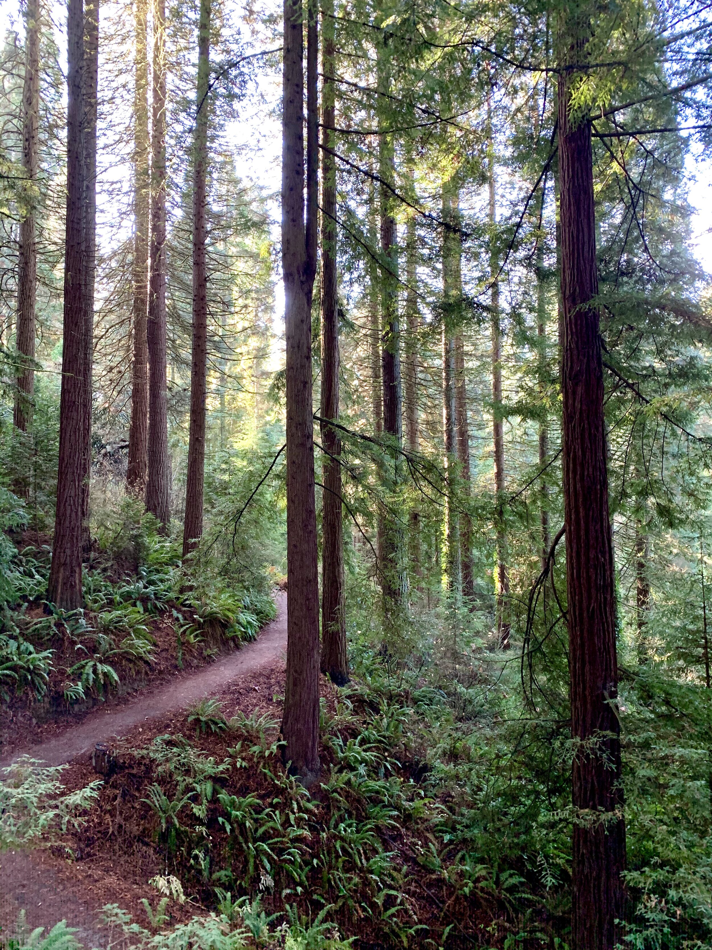
Hoyt Arboretum, Portland Or (aka, a reason you need to get up to the PNW)

Hoyt Arboretum, Portland Or (aka, a reason you need to get up to the PNW)

So, the secret best route starts in Los Angeles, heading north on the 101. When you reach Santa Barbara, the 101 will converge with the 1 and you’ll be met with some of the most beautiful coastline you’ll see on the trip. From here, I suggest heading through the Los Padres National Forest via the 154. This is an incredibly gorgeous drive, yet incredibly winding. You’ll have plenty of chances to stop and see some gorgeous views (like THESE from the beginning of my latest YouTube video) and spot Lake Cachuma.

You’ll then continue up the 101, passing through Santa Cruz and San Luis Obispo, two trendy and smaller Central California cities. Of course, feel free to stop at any time. This drive can take as many days as you want, but when my family and I recently visited Portland, we did it in 2.

Mt. Tabor Park in Portland, OR

Mt. Tabor Park in Portland, OR

Once you reach San Francisco, you’ll cross through the city and onto the 5. I prefer doing it this way because if you take the 5 up from Los Angeles, you not only have to go through the Grapevine (as we call it), but you also have to pass through Coalinga (cow country), and Fresno (the literal middle of nowhere, sorry Fresno).

This section of the 5 is amazing. You’ll pass by plenty of National Forest Land and Lassen Volcanic National Park, if you want to stop and see some sites.

Eventually you’ll reach Redding. Redding is a super underrated Northern California Town. It’s surrounded by tons of hiking opportunities, including the Whiskeytown National Recreation Area. There’s enough to do in Redding to last a week, and there are plenty of hotels, camp spots, and restaurants if you’re just passing through. I’d highly recommend the Americana Modern Hotel, the only dog friendly hotel in the town. This hotel is a newly renovated hotel that’s fairly central to a lot of different food options (including Mod Pizza and Chipotle if you’re plant based like me). The service was fantastic, and a stay comes with breakfast. This is also exactly halfway between Los Angeles and Portland, so it makes the perfect overnight rest after an 8 hour drive.

Dundee, OR (wine country)

Dundee, OR (wine country)

Just an hour north of Redding is a Californian gem: Weed, CA. Weed is ironically a town full of college students that basically leans on the commerce of a lone souvenir shop selling, you guessed it, weed themed apparel and gifts. It’s a hilarious little pit stop, and there’s a bathroom in the Dollar General across the street from the gift shop. Even if you don’t care about weed whatsoever, it’s fully worth the stop just to take a picture of the sign. After this, you’ll finally cross the bridge over Lake Shasta, and enter the mountains and pine forests for the rest of the drive.

A little further north, you’ll pass by Mount Shasta, an active volcano that stands at more than 14,000 feet. Mount Shasta is met at its base by Lake Siskiyou, a gorgeous lake great for paddle boarding, hiking, and boating, and definitely a valuable stop if you have the time.

It’s supposed to say “Welcome to Weed.” You get the picture. It’s also on a hill and this is the straightest I can get the picture so I’m sorry…

It’s supposed to say “Welcome to Weed.” You get the picture. It’s also on a hill and this is the straightest I can get the picture so I’m sorry…

Once you pass the Siskiyou Pass and over the Oregon state line, the drive up the 5 is fairly easy. You’ll pass through plenty of National Forest Land, such as the Umpqua National Forest, and most of your drive will be surrounded by pine trees. A worth-it stop on your way up is Crater Lake National Park, but it will add quite a bit of time to your drive.

Disclaimer: be careful driving the Siskiyou Pass during winter. Carry chains.

Mount Shasta from highway 5 heading south.

Mount Shasta from highway 5 heading south.

There’s so much beauty in Oregon, but you’ll pass through quite a bit of farmland too, once you’re out of Southern Oregon’s mountains. It’s definitely worth checking out the college town of Eugene, as well as the capital city of Salem.

Truly, there is so much to see between Los Angeles and Portland, and probably more than is even on this list. These are simply my must-sees. California is a vast and diverse state larger than some countries, so it does take quite a bit of dedication and coffee to drive it all without switching drivers. But, it’s so worth it. You’ll pass some of the prettiest sights on the west coast along this route, and it’ll have you wanting to see the rest of these two states as soon as you can.


If you’re interested in traveling to these two states, plus 46 more in one season, check out my NEW EBOOK, available in the shop!

What It's Like to Spend Thanksgiving in an Airbnb

An Anecdote From A Full Time Solo Traveler

It’s that time of year again, and holidays for so many people, mean traveling to familiar places to visit family. This year, my immediate family and I decided to do something a little different. We drove 1,000 miles from Los Angeles, CA to Portland, OR to spend Thanksgiving, just the four of us. We did this for a few reasons, one of which being that my parents wanted to do something special for their 29th wedding anniversary, since it always overlaps with the holiday. We wanted to explore somewhere new, since my family had never been to Oregon, and Southern California also doesn’t get a real autumn, so we made it our goal to get a little taste of the cold weather this year before I head off to South East Asia for the rest of the winter.

Dundee, OR (wine country)

Dundee, OR (wine country)

We opted to stay in a cute little Airbnb on the SE side of Portland, which was exactly 20 minutes from everything. We were able to experience all of the important sites and visit family in the area no problem. But we planned on doing an all vegan Thanksgiving in our Airbnb, which lead to some interesting adventures in cooking.

We chose this type of accommodation because it would allow us to have a kitchen and the privacy of not having people walking by our rooms all night (I’m clearly not a fan of hotels). The thing is, our kitchen was missing so many tools, from a pasta strainer to serving utensils (try making a huge family dinner without a big spoon, I dare you). This made for some interesting and creative improvisations. Think, spatulas to serve stuffing, rice, and green bean casserole, and a bread knife to cut Tofurkey. Because the truth about travel is that it can be uncomfortable. Not everything is going to be perfect, and that’s kind of the point of an adventure. You figure out how to make it work as you go along, and you have fun doing it because of the place you’re in, or the people you’re with, or both.

Portland International Rose Test Garden in Fall. Clearly, the roses were hibernating already.

Portland International Rose Test Garden in Fall. Clearly, the roses were hibernating already.

But this article isn’t about food, it’s about feeling at home when you’re so far away from it. While Airbnb’s message is about helping you feel at home when you’re away, there’s always a bit of displacement that happens when you’re staying in a new space. I’m pretty used to this, but I’m also used to traveling in a constant vehicle that feels like home (and will be hitting the road in my actual tiny home come January). But because this was such a different type of travel to me, it did take some adjusting. I got to unpack into a real closet! I had a full bathroom, and constant access to a shower! And I still got to experience a new place (weird, I guess this is how most people do the travel thing). More important than amenities though, I had constant access to the most important people in my life, and as a solo traveler, this is a rare luxury.

This was an interesting trip. I’d never spent a holiday other than the Fourth of July away from Southern California, and while I’d spent plenty of Decembers in my college town away from my family, this trip felt different, because this time I was away with my family. That made it so that this crazy cooking adventure felt a little like home, even though we were in such an unfamiliar place. The important thing about the holidays is that you’re with the people you love, regardless of where you are in the world.

Mt. Tabor Park in the early morning

Mt. Tabor Park in the early morning

Being away from home made every moment exciting. There was no waiting around for dinner to be done, the way Thanksgiving usually goes, so we didn’t find ourselves snacking all day and filling up before the main course. Instead, on Thanksgiving, we went out to Washington Park and Pittock Mansion to look at some of the best views of Portland, and got home in the afternoon to start cooking. Instead of my brother spending his week doing homework, he was eager to get out and practice his photography in the woods. My dad and I spent time hiking in a local park instead of our usual hills, and my mom and I got excited about trying new vegan restaurants instead of our go-to’s. It made everything an adventure.

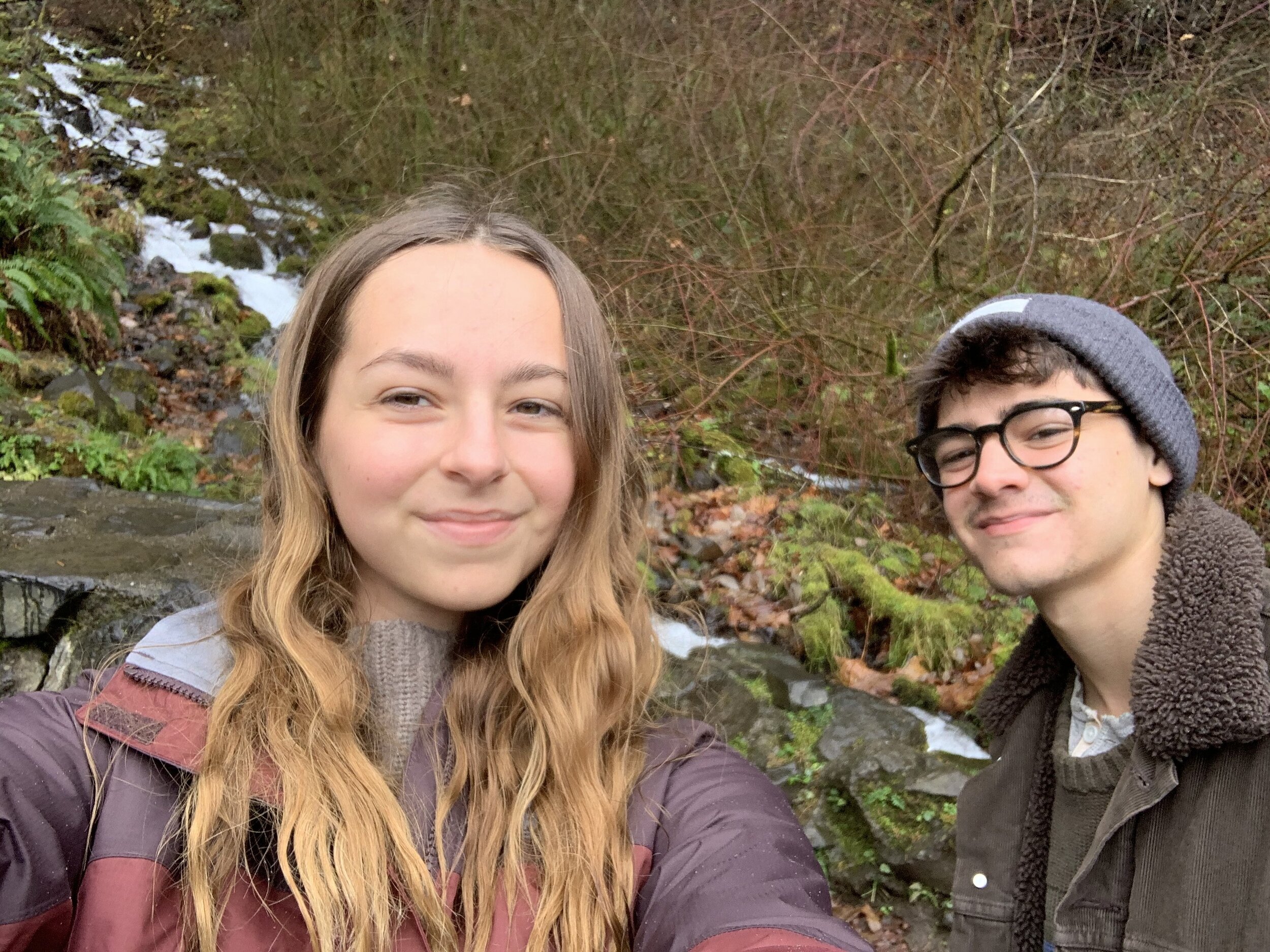
My brother and I at Wakheena Falls, Columbia River Gorge area

My brother and I at Wakheena Falls, Columbia River Gorge area

And that’s the strange thing about full time travel. You get to a point where it’s just life to constantly be moving and seeing new things every day (which I love, despite the complete lack of stability), but it’s a completely different experience when you’re with people who don’t live that nomadic life. Suddenly everything is seen as new again.

Happy Holidays, everybody. Back to our regularly scheduled programming on Sunday with one more little guide to the PDX area.

-HWS


If you’re curious about my life as a solo female full time traveler, and want to know how I managed to explore all 48 connecting states in 3 months, check out my new ebook, Around the States in 90 Days, in the shop.

Top 5 Most Instagramable Natural Spots in Oregon

Oregon is hands down one of my favorite places in the US. It’s almost as diverse as California, yet rivals it when it comes to changing seasons. I just had the opportunity to spend my Thanksgiving week properly visiting Portland. And while Portland is a cool little city, I kept finding myself drawn to Oregon’s nature. The Pacific North West is one of the best places in the country for mountains, pine trees, and even beaches, and I’ve compiled a list of my favorite natural places in Oregon to photograph (or, those that I’ve been to so far).

To follow me on Instagram for more pictures like these, and plenty of travel inspiration, click HERE or visit the CONTACT page.

Geotag Disclaimer: if you choose to use geotags on your Instagram feed, please be responsible, and keep local secrets you find that aren’t on this list, well, secret. Geotags have the tendency to draw crowds and ruin natural spaces, so in line with Leave No Trace, let’s leave no map too.

So, grab your camera or phone, don’t forget a good snack, and hop in the car. This ride’s about to get insanely pretty.

Crater Lake National Park

Crater Lake National Park

Haystack Rock

While this one might be a bit obvious to those of you engrossed in the crazy world of Instagram, it’s a spot that tops many Oregon travelers’ bucket lists by a long shot. Located on Cannon Beach, Haystack Rock is a huge rock formation known for its famous reflection in the sand. This is easily one of the most popular spots in Oregon, and for good reason. The Oregon coast is a famous stretch of coastline, and this is easily the most famous beach on the drive.

Cannon Beach is a dog friendly beach, and has free parking only a couple blocks away. It’s only about an hour from Portland, and is super easy to find.

A tip for my vanlifers: It’s a bit (and by a bit, I actually mean a lot) hard to find affordable camping, let alone safe boondocking spots, so if you’re living that vanlife, you might want to dive up over the state line and stay at the rest stop that’s 40 minutes away.

Haystack Rock on Cannon Beach, Oregon Coast

Haystack Rock on Cannon Beach, Oregon Coast

Hoyt Arboretum

If you’re staying in Portland, this is an awesome place to go to lose yourself amongst the PNW’s famous pine trees and redwoods. The Hoyt Arboretum is located within Washington Park, and is basically a living museum. You can grab a map at the visitor center, or just wander the marked trails. Each area of the park features a different type of tree, from redwoods to maple. This was actually the first time my family was able to snag a glimpse of our West Coast redwoods.

The Hoyt Arboretum is completely dog friendly, and free to enter, but you do have to pay for parking. You can hike about a mile (one way) to Pittock Mansion from the visitor center if you want a view of the city too!

Redwood Deck in the Hoyt Arboretum, Portland

Redwood Deck in the Hoyt Arboretum, Portland

Smith Rock State Park

Located about 30 minutes outside of Bend, Smith Rock State Park is known by rock climbers across the country. I am not a rock climber, and I came here with a friend from the road when we both happened to be in Bend. There are quite a few hiking trails here for all hiking abilities, if you’re not into climbing, and there are spectacular views all around. This is the best place for you to head if you’re in Oregon and craving some desert-esque landscapes. It reminded me of this park in Los Angeles that I used to visit with my parents called Vasquez Rocks (which I largely credit my love of the outdoors to).

Smith Rock does allow dogs and has paid camping available.

Smith Rock State Park

Smith Rock State Park

Crater Lake

I’ve talked about Crater Lake a couple times on here, but it’s the deepest lake in the country, so how could it not make it onto this list? With its deep, blue water and towering pine trees, Crater Lake is far more than just a lake. This National Park includes a beautiful scenic drive, volcanic-formed pinnacles, and a little island dubbed Wizard Island. Even if you’re not a big hiker, you’ll be able to grab some of the best and bluest shots to fill that ‘gram with at Crater Lake.

A tip for my vanlifers: Lost Creek Campground is a bit out of the way, but only costs $5 a night! It gets super cold, even in the summer, so make sure you have the right gear!

Crater Lake National Park, aka one of the coldest days I’ve spent on the road so far

Crater Lake National Park, aka one of the coldest days I’ve spent on the road so far

Multnomah Falls:

On the same level of Insta-popularity as Haystack Rock, you’ve likely seen a picture or two of Multnomah Falls come across your feed. This was a bucket list item of mine for a long time. Multnomah Falls is part of the Columbia River Gorge area, on National Forest Land, and is a 620 foot tall two-tiered waterfall that features a bridge. You can hike to the top, or you can get that perfect shot from the bottom (it was raining, so my family chose the latter).

There is free parking just across the street, and the falls is a dog friendly area. Just a few minutes down the road, you’ll find Wahkeena Falls as well, another large waterfall in the area with a hiking trail.

Multnomah Falls in late November

Multnomah Falls in late November

There are plenty of super beautiful spots throughout Oregon, but these are easily my favorites I’ve been to so far. Oregon in itself is incredibly pretty, so make sure you get off that beaten path a little bit too.


To learn more about my favorite places in the country, make sure you check out my full 3 month, 48 state road trip itinerary, available now in the shop!

My Top 10 Favorite US States

If you follow me on Instagram, you’ll know that my bio announces that I’ve been for 49 of the 50 US states. Because of that, two of the most common questions I get on basically every platform are “what state are you missing?” and “what are your favorite states?” Well, the one I’m missing is Alaska, and there’s a maybe chance that it might be in the plans for 2020 (but nothing’s official yet). The harder question to answer is which states are my favorite, and the reason for that is because the US is so diverse. Every state has something unique to offer, but there are 10 that stand out above the other 39 I’ve been to.

Here are my top 10 US states:

Joshua Tree National Park, CA

Joshua Tree National Park, CA

10: Minnesota

When I reached Minnesota on while I was traveling over the summer, it was one of the northernmost destinations I had on my list. I was heading to Voyageurs National Park, which was located right on the Canadian Border. When I was driving north, I remember feeling like I’d finally accomplished something. Minnesota was one of the prettiest states I’ve been to. The entire thing is lined with pine trees, and the highway to the national park was one of the most unique drives I’ve done. The trails in the national park often overlook lake Kabetogama, and provide views of Canada on the other side. The people in Minnesota were also super nice, and made it really easy to enjoy my time there.

Lake Kabetogama, Voyageurs National Park, MN

Lake Kabetogama, Voyageurs National Park, MN

9: Washington

This was a strange one to put on this list for me. While it’s incredibly similar to Oregon in terms of its landscape, it had a very different energy. Washington has a bit of a spooky vibe, and it turns out, it’s actually known for UFO and ghost sightings. The national parks here are absolutely gorgeous. Olympic is super unique, and is home to multiple different landscapes: from mountains, to lakes, to beaches, to rain forests. North Cascades is a unique free park interspersed with national forest land. Mount Rainier is home to glaciers, an impressive mountain, and tons of wildlife. Washington does have a ton to offer, but it’s a very different feeling than the other PNW state, which I’ll get to later on this list.

Rialto Beach, Olympic National Park, Shore Section, WA

Rialto Beach, Olympic National Park, Shore Section, WA

8: Maine

Maine is actually going to be the only eastern state on this list. That doesn’t mean I don’t like the east coast, it’s just that most of the east coast is known for their cities, and I’m a nature girl. I absolutely loved Maine though. As I drove into Maine, I saw my first “moose crossing” sign, and it was the first time I saw pine forests since leaving Colorado nearly two months prior, so it’s got a special place in my heart for that reason. Maine really is absolutely gorgeous. It’s a mixture of pine forests and ocean, and Acadia National Park is a gorgeous and unique small park. The people were nice, everywhere was beautiful, and it had some of the best early morning sunrises I’ve ever seen.

Acadia National Park, ME (and the Atlantic Ocean)

Acadia National Park, ME (and the Atlantic Ocean)

7: Utah

I absolutely loved Utah. It’s home to five incredible national parks, including Bryce, which holds the largest collection of hoodoos in the world. The entire state feels a bit like a national park though, and the highways bring you through green mountains, big cities, and rolling farmland. The entire state, from bottom to top is absolutely gorgeous, from the national parks in the southern half of the state to the mountains you can see from something as simple as a Starbucks in Logan.

The famous hoodoos of Bryce Canyon National Park, UT

The famous hoodoos of Bryce Canyon National Park, UT

6: Wyoming

I’ve written about Wyoming a few times now, and that just means it had to make it on this list. Wyoming is one of my favorite mountain states. Wyoming simply has some of the most unique landscapes in the country, from active volcanoes in Yellowstone, to long extinct ones at Devils Tower. This state is super diverse in its wilderness, morphing from the high mountains of the Tetons to the almost-desert of Fossil Butte in the southern part of the state. It’s also home to some of the most diverse wildlife in the country. Here, you can see bears (grizzly and black bears), moose, bison, eagles, elk, and even wolves. Needless to say, if you love nature, Wyoming is the place for you.

Bison hanging out in Yellowstone National Park, WY

Bison hanging out in Yellowstone National Park, WY

5: Arizona

Arizona was actually the place I chose for my first solo trip. I went to the Grand Canyon solo during my last spring break ever, and it was one of the best experiences of my life. Arizona is a beautiful state, and one that truly feels unique from its neighboring California landscape. Between its red rocks and the fact that its home to one of the Earth’s natural wonders, Arizona is one of the most beautiful southwestern states. Here, you’ll find classic saguaro cactuses, unique rock formations, and plenty of tourists, which just goes to show you that this state is just incredible. It’s popular for a reason.

This view will make you cry, Grand Canyon National Park, AZ

This view will make you cry, Grand Canyon National Park, AZ

4: Hawaii

Hawaii is an old favorite of mine. I’ve been traveling to Hawaii since childhood, and its landscapes never fail to blow me away. I’ve been to three of the four main islands, and by far, Maui is my favorite. Here, I have memories of learning to surf, eating too much shave ice, and jumping off of black rock into the reef and crystal blue ocean below. Hawaii is simply one of the best vacation destinations in the country, and while Maui is my favorite, the other two islands I’ve been to, Kauai and Oahu have been beautiful as well.

Black Rock on Kaanapali Beach, Maui, Hawaii (photo ca. 2012)

Black Rock on Kaanapali Beach, Maui, Hawaii (photo ca. 2012)

3: Montana

Montana is home to my favorite place on Earth, Glacier National Park. Glacier is an absolutely gorgeous mountain park that’s home to some of the only glaciers in the continental US. Here, I hiked my favorite hike ever: Grinnell Glacier. Other than Glacier National Park, Montana is actually gorgeous. As you enter the state from Wyoming, you’ll be greeted by Big Sky Montana, an open, vast expanse of land with, well, some of the biggest sky you’ve ever seen. I also had the privilege of staying a night in Bozeman, a cute little outdoorsy town surrounded by national forest land. Montana is truly a nature-lover’s paradise, and is more than worth exploring.

Grinnell Glacier, Glacier National Park, MT

Grinnell Glacier, Glacier National Park, MT

2: Oregon

I’ve been to Oregon three times now, and I’m actually writing this from an Airbnb in Portland. Oregon is such a beautiful state full of my favorite forested landscape, without the weird Washington vibes. It’s home to Portland, a quirky little PNW city, the Oregon coast, the outdoorsy town of Bend, the climber’s paradise of Smith Rock State Park, and of course, the deepest lake in the country: Crater Lake. Crater Lake was absolutely stunning, but also one of the coldest places I’ve been, so make sure you have the right gear! Oregon simply seems like it’s full of endless adventures, and it’s a place that I don’t think I’ll ever get sick of visiting.

Multnomah Falls, Portland, OR

Multnomah Falls, Portland, OR

1: California

Okay, so I might be biased, but my home state is the best state in the country. It’s so huge, and spans the most diverse landscapes within one state. Here, you’ll find desert, mountains, forests (including the world’s tallest trees, the redwoods), cities, and of course, beaches. California is home to nine national parks, including a volcano, and the state includes one of the most beautiful scenic drives in the country: Highway 1 through Big Sur. California truly has a little something for everybody, no matter what you’re traveling for.

Glacier Point, Yosemite, CA

Glacier Point, Yosemite, CA

Coming up with this list was actually super hard. I love everywhere I’ve been for different reasons, even the places I say I hated. The thing is, traveling gives everyone a unique experience, and we have to appreciate it for that. Every destination is going to leave a different impression on every traveler, and the US is home to such uniqueness that everyone is bound to have their own unique experience.


To read more about the 48 contiguous states, make sure you check out my complete road trip route in my new ebook, dropping December 1, 2019 in the shop!

How to Visit Los Angeles and Completely Avoid the City

If you’ve been following my journey, you’ll know that I’ve spent some time in my home city of Los Angeles since completing my 3 month road trip earlier in the fall while I transition to vanlife. I used to strongly dislike my home because the cities were all I knew. I was used to visiting LACMA in the city, the pier in the other city, and the Pantages Theater in the other other city.

If you’ve read My Journey, you’ll know my National Park obsession and love for hiking didn’t start until I was already living somewhere else for university, and since being back temporarily, I’ve managed to pretty much completely avoid visiting the city at all. While this might seem impossible, the trick is in the mountains.

Now, you might be thinking, “what mountains?” because usually, when we think of mountains in Southern California, we picture the snow capped peaks of the Big Bear and Arrowhead area, or even the almost constantly cold Mammoth Mountain. We think of Baldy and Whitney, but never do we picture the Santa Monicas.

View from the trail to Eagle Rock in Topanga State Park

View from the trail to Eagle Rock in Topanga State Park

The Santa Monica Mountains are a strange type of mountain. Their flora almost mirrors that of the nearby desert, and they’re home to mountain lions, coyotes, and rattlesnakes. But they’re also home to the canyons that connect the Valley to the beaches. They’ve been the site of multiple wildfires in recent years, and with their recent regrowth, they’ve regained their status as the go-to hiking spot for city dwellers. The Santa Monica Mountains are a National Recreation Area, run by the National Park Service, and they include multiple state parks, as well as Malibu’s famous beaches.

It’s entirely possible to visit Los Angeles and never even venture as far south as Hollywood, and even if you’re a city lover, it never hurt to take a day to explore your destination’s natural areas, get some fresh air, and realize that maybe, there’s much more to a place than what you see on TV.

Malibu Creek State Park

Malibu Creek State Park

State Parks

Two iconic state parks in the SM Mountains area are Malibu Creek and Topanga. Both offer miles of hiking trails and stunning views of the mountains. Both do offer campgrounds, but only Malibu Creek has frontcountry camping.

Malibu Creek was actually the first place I ever camped as a young child, and it has a great family friendly environment, and plenty of short and easy trails. One of the longer trails you can do in Malibu Creek is the Malibou Lake Trail, which adds up to be about 7 miles total, offering expansive views of the mountains, and includes a creek crossing. You’ll also pass through the famous MASH site (pictured below), so even though you’re avoiding the city, you’ll still get to experience some key TV history. I highly suggest downloading the AllTrails app before attempting this hike, especially solo. Some parts are very confusing.

MASH site, Malibu Creek State Park

MASH site, Malibu Creek State Park

Topanga is known for some tougher trails. Hiking to Eagle Rock is one of the most iconic hikes in the area, and although it’s only about a 4 mile total hike from the Topanga State Park entrance, it gains almost 1,000 feet in elevation. This hike does offer stunning views of the canyon, and even the nearby coast on a clear day.

Top of Eagle Rock hike, Topanga State Park

Top of Eagle Rock hike, Topanga State Park

My favorite hike in Topanga State Park, though, is Hondo Canyon via the Backbone Trail. The Backbone Trail is a 65 mile long trail that traverses the SM Mountains, and you can hike a few miles of it here, from Old Topanga Road to the Rosas Overlook, from which you can see Calabasas Peak. This is a 10.1 mile hike, and it takes you through canyon overlooks, Southern California Forest, and mountains passes. Hondo Canyon is a hike ideal for advanced hikers, but I’ve seen hikers of all levels on the trail. Just make sure you have some good gear, a yummy snack, and plenty of water.

When hiking in the Los Angeles area, make sure you’re aware of your surroundings and keep an eye out for larger wildlife. This area is known for mountain lion and coyote activity. Rattlesnakes are also common in the SM Mountains.

Hondo Canyon Trail, Topanga State Park

Hondo Canyon Trail, Topanga State Park

Malibu Beaches

The Santa Monica Mountains also includes some of the nearby beaches, and if I’m being totally honest, Malibu beaches are far better than Santa Monica Beaches. The most notable one to mention here is actually one that was severely affected by 2018’s Woolsey Fire: Leo Carrillo. Leo Carrillo is easily one of my favorite beaches in the Los Angeles area. It’s generally pretty empty, and is one of the only beaches in the area that allows street parking on PCH (perfect for you overlanders who don’t want to pay for parking). It’s actually part of another state park in the area, Leo Carrillo State Park, where you can camp right on the beach. Leo Carrillo is also one of the only dog beaches in the area, and your pooch is allowed anywhere on the north side of the beach on leash. The south side of the beach is home to tide pools, and is generally the more family friendly side of the beach. Leo Carrillo finally reopened to the public in June 2019, but it is still being rebuilt.

Leo Carrillo State Beach (and Josey)

Leo Carrillo State Beach (and Josey)

Other notable sites

Of course, the Santa Monica Mountains are enormous, so there’s plenty to see in the area. If you’re interested in movie history, Paramount Ranch is the place for you. While the old western town burned down in the Woolsey Fire as well, they’re currently rebuilding it to commemorate the many movies that have been filmed there. You can still see the church (pictured below), and go hiking in the area.

Paramount Ranch, Santa Monica Mountains area

Paramount Ranch, Santa Monica Mountains area

Another great area is the Circle X Ranch and Sandstone Peak area. Sandstone Peak is a steep hike, but you’ll be rewarded by surreal views, and the entire peak overlooks the Valley below.

Top of Sandstone Peak

Top of Sandstone Peak

The Santa Monica Mountains are actually so big that I haven’t even explored a huge portion of the area. Next up for me is Malibu Lagoon and Point Mugu State Park, but there’s also so much to keep coming back to. It just goes to show you, you can have an adventure even in your own home, and oftentimes, there’s more left to discover than you think.