road trip

A Vanlife Guide to Sedona, AZ

If you’re a person who lives on wheels, or even just a person who hates winter, it’s no secret that Arizona is the place to be in January. Nearly every person living that vanlife on the west coast (and some from the east!) comes to Arizona at the end of January every year. After the annual gatherings in Quartzite, me and my new Van Fam (follow them at emma.goes and theotherground) headed out to Sedona, a place I’d been dreaming of visiting for about two years now.

Sedona is one of the most powerful spiritual centers in the country, and is home to tons of red rocks and beautiful hikes. Prior to coming out here, I had no idea how easy it would be to be an overlander in Sedona, but the truth is, Sedona is one of the most vanlife friendly cities I’ve ever visited.

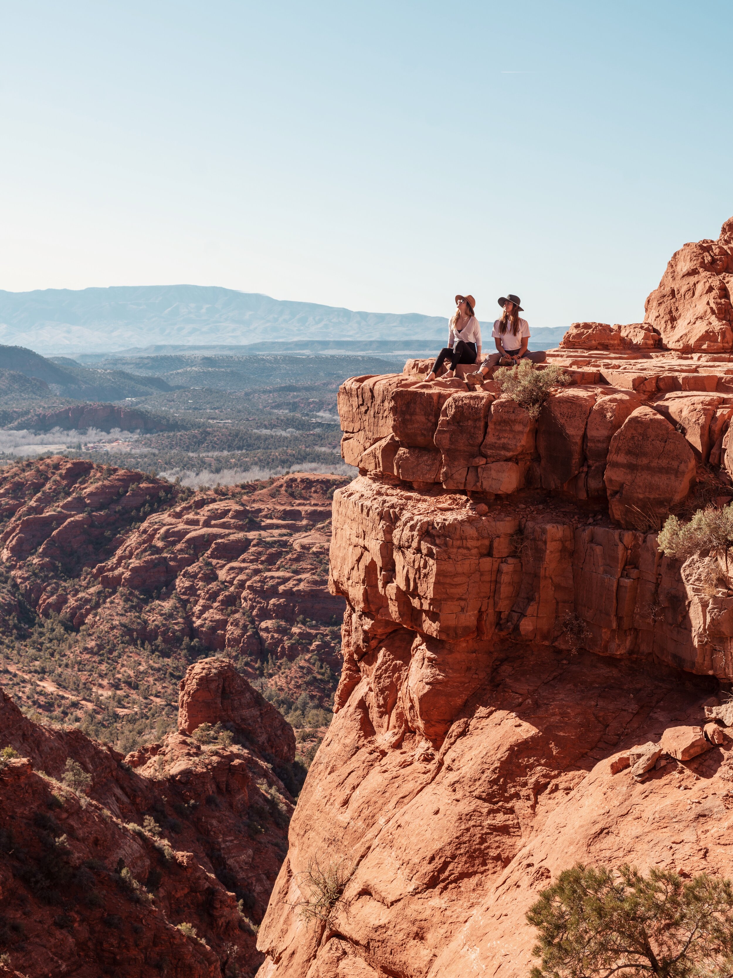
Me and Emma at Cathedral Rock. Photographer: Brien @theotherground

Me and Emma at Cathedral Rock. Photographer: Brien @theotherground

Where is Sedona?

Sedona is located in north-eastern Arizona, making it one of the colder areas of Arizona. It is about 7 hours from the California coast, 5 hours from Joshua Tree, and 3.5 hours from Quartzite, AZ.

Where should I park?

As I said, Sedona is incredibly van friendly, but that means it’s incredibly camp friendly too. This isn’t the type of city where vanlifers are lining the streets, it’s a city surrounded by National Forest land. The best spots to park are along Forest Road 525. You’ll be sure to meet plenty of other van dwellers, and if you drive far enough, you’ll reach the Palatki Native American Ruins. You obviously can’t park at the ruins, but there are spots nearby where you’ll have vast views of the red rocks.

At camp, somewhere on FR525. Photographer: Emma @emma.goes

At camp, somewhere on FR525. Photographer: Emma @emma.goes

What are the best restaurants?

We frequented two amazing vegan/vegetarian restaurants while we were in Sedona: ChocolaTree and Local Juicery. A few of our friends actually work at Local Juicery, so definitely go say hi and support your fellow vanlifers (plus, their avocado toast is the best I’ve ever had). ChocolaTree is more of a spiritually minded spot. It has more of a sit-down restaurant feeling to it, so it’s worth going if you’re craving a hot dinner.

Where can I get water?

Living off the gird means certain things aren’t as easy as they could be in a house. One of those things is water. Luckily, ChocolaTree has a spigot with fresh spring water outside their restaurant that they allowed us to fill our 6 gallon tanks with.

Me at Devils Bridge—the most famous hike in Sedona! Photographer: Emma @emma.goes

Me at Devils Bridge—the most famous hike in Sedona! Photographer: Emma @emma.goes

Where can I go to get in a work day?

There’s always Starbucks, but if you’re looking to get in a work day and catch some views, head to Creekside Coffee. Here, you’ll have views of Snoopy Rock, and can snag some WiFi, even outside.

If you’re interested in learning more about making money on the road, check out Wired Creatives HERE!

Cathedral Rock from below

Cathedral Rock from below

What are the best hikes to do?

If you’ve been following me for a while, you know that hiking is a huge reason I go to certain places. Sedona is a huge hiking hub, so we made it a point to hit a few of the Coconino National Forest trails while we were out there.

Devils Bridge: Devils Bridge is easily the most popular hike to do in Sedona. It features a vast, natural bridge photo op and the entire hike is about 4 miles long. Expect crowded parking, but if you have 4WD, you can make it to the real trailhead and skip walking along the dirt road. If there’s no parking, no worries, you can park on the main road too, but it’ll add about a half mile of walking. Prepare for crowds at the top too. We got lucky with a gloomy day, and only had to wait behind about 6 people each, but normally, it’s a crowd of about 150 people at the top.

Boynton Canyon Vortex: This was one of the most powerful vortexes I experienced in Sedona. It’s not a long hike, but it features red rocks and two spires that are said to represent the divine masculine and divine feminine. If you’re a spiritually minded person, you’ll love this spot, and if you get there early enough in the day, you might just catch the flute player who goes up there daily to hand out heart shaped rocks to people.

Cathedral Rock: This was my absolute favorite spot we went during our time in Sedona. It’s a hike basically made of rock scrambles, which made is extremely fun, and had some amazing photo opportunities at the top. Keep an eye out for the vortex trees—trees that appear to have been swirled (this phenomenon happens due to the high amounts of spiritual energy in the area).

Me and Emma at Cathedral Rock. Photographer: Brien @theotherground

Me and Emma at Cathedral Rock. Photographer: Brien @theotherground

Sedona is an absolutely magical spot. Whether you’re a spiritual person or not, Sedona will change the way you see the desert. The hikes here are breathtaking, the camping is quiet and peaceful, and it’s a great place to feel like you have a sense of community on the road.

All the National Parks on the East Coast, Ranked

Okay, well not all of them. I haven’t been to the Florida National Parks, and I promised when I started this blog that I’d never write about a place on here that I haven’t personally been to. Instead, this is everything north of Florida. There aren’t a ton of National Parks on the East Coast of the United States, but there are definitely a lot of great qualities about the ones that do call these states home.

I’ve been to all of the National Parks along the East Coast that aren’t located in Florida, so I’m so excited to share my love for them with all of you. They’re all so unique. On the East Coast, we’ve got swamps. We’ve got mountains. We’ve got waterfalls. The East Coast is incredibly green, and is home to so much wildlife, from armadillos in the south to moose in the north.

This is every National Park on the East Coast (except Florida), ranked.

I do want to clarify that this list only contains NPS sites recognized as having Park status. There are so many more NPS sites on the East Coast that are also worth visiting.

Congaree National Park, SC

Congaree National Park, SC

6: Cuyahoga Valley, OH

I decided to throw two non-coastal states on this list because, let’s face it—there just aren’t a lot of National Parks on the East Coast. Most of the countries parks are out west, but that doesn’t mean these parks don’t deserve some love too! And Ohio and Kentucky are most certainly eastern states, so let’s get on with it.

I did really like Cuyahoga Valley, but it has to sit at #6 because it is a small park. There isn’t too much to do and it’s built within a neighborhood. That doesn’t mean it’s not absolutely gorgeous though! Cuyahoga Valley is amazing for waterfall chasing, and has a few good hiking trails as well! Don’t miss Brandywine Falls, and make the little trek out to Bridal Veil Falls—both are gorgeous!

Brandywine Falls, Cuyahoga Valley National Park, OH

Brandywine Falls, Cuyahoga Valley National Park, OH

5: Mammoth Cave, KY

This was super hard to put this low on the list because I genuinely loved my time in Mammoth Cave. Its campground was amazing (honestly up there with my favorite campgrounds, and it would’ve made this list if the list was longer), and the people were so nice. It was a nice cross between a small and big park (no entrance fee, but so much to do, and it’s all contained in itself). Mammoth Cave is the largest cave in the world, at over 600 miles long. The cave itself is awesome, but the park didn’t have a ton of hiking available to me because the ferry was closed when I was there, so I couldn’t access part of the park. Definitely get there early and book a cave tour. They don’t cost very much, and it’s spectacular. I wish I got to take a tour, but they were all sold out by the time I decided to do it. But honestly, Mammoth Cave is an absolutely gorgeous area—definitely add it to your list.

From inside the largest cave in the world, Mammoth Cave National Park, KY

From inside the largest cave in the world, Mammoth Cave National Park, KY

4: Congaree, SC

Okay, this feels like an unfairly low rank for this park because it’s actually one of the most unique places I’ve been. I promise this list keeps getting better! Congaree is genuine swampland. It’s home to tons of amazing insects and spiders, owls, armadillos, and even an invasive crocodile. It’s free to enter, but is also a contained park, so it had a similar vibe to Mammoth Cave. This is one of the most kid friendly parks I’ve been to, and I actually took my little cousins. We did the boardwalk loop, and they became junior rangers, which was so much fun, so definitely do that while you’re there (or in any park for that matter). Take this park in slowly. There’s so much to see that you’ll miss if you’re moving too fast.

The unique landscape of Congaree National Park, SC

The unique landscape of Congaree National Park, SC

3: Shenandoah, VA

Alright, so I genuinely love Shenandoah National Park. I had an absolutely beautiful, nearly spiritual experience here, and it’s such an absolutely gorgeous park full of so much wildlife (aka, my favorite thing about camping). I saw deer, bears, frogs, and even had a butterfly land on me for about 10 minutes. I met another empath here who taught me to listen to the forest. I had an entire campground to myself in the rain. But more than anything, this park has everything you could need. There’s showers and laundry available, gorgeous hikes, and super nice people.

I personally did two hikes in the park, and not the one I came to do. I originally planned on hiking Old Rag but it was going to be the hottest day of the year, so I opted for one that was closer to camp. My first day, I hiked Doyle River Falls, which has three waterfalls, some small creek crossings, and plenty of time to play and swim in the falls. It is super steep heading back though, so be ready for that incline! The second hike I did was Rip Rap, a ten mile loop trail with an ice cold, blue swimming hole in the middle. This hike is a must-do, but hike it backwards: downhill 7 miles first, swim, and then uphill for 3 miles!

Waterfall #3 of the Doyle River Falls hike, Shenandoah National Park, VA

Waterfall #3 of the Doyle River Falls hike, Shenandoah National Park, VA

2: Great Smoky Mountains, TN and NC

The Smokies are the most visited National Park in the country. They’re located across two states, Tennessee and North Carolina, and they’re so, so pretty. The Smokies get their name from the thick fog that rests on the mountains every day, and they’re a great place to see wildlife, and tons of biodiversity in the plants. It’s also worth driving part of the Blue Ridge Parkway if you get the chance. I hiked Charlie’s Bunion while I was there and it was so pretty, I made it my profile picture on basically every social media platform I use. The only reason this one is #2 instead of #1 on this list is because of the crowds. There are tons of people in the Smokies, so prepare for tourists, and hit the road early if you can! This park has free entry, but it’s definitely a big park, so give yourself time to drive through and see the sights!

This picture: me at Charlie’s Bunion, aka my profile pic everywhere. Great Smoky Mountains National Park, TN/NC

This picture: me at Charlie’s Bunion, aka my profile pic everywhere. Great Smoky Mountains National Park, TN/NC

1: Acadia, ME

Acadia was on my list of my favorite places I visited in 2019, so it’s only natural that it was #1 on this list. Acadia is the perfect mix of mountains and ocean: my two favorite landscapes on this planet. You’ve got pine trees, rocky cliffs, mountains to climb, and rocks to boulder. Acadia is located on an island, so there are plenty of opportunities to see the ocean. If you go in the summer, make sure you get there early in order to do famous attractions like Sand Beach, but if early isn’t exactly your speed, just show up and enjoy the ride (around the gorgeous loop road of course).

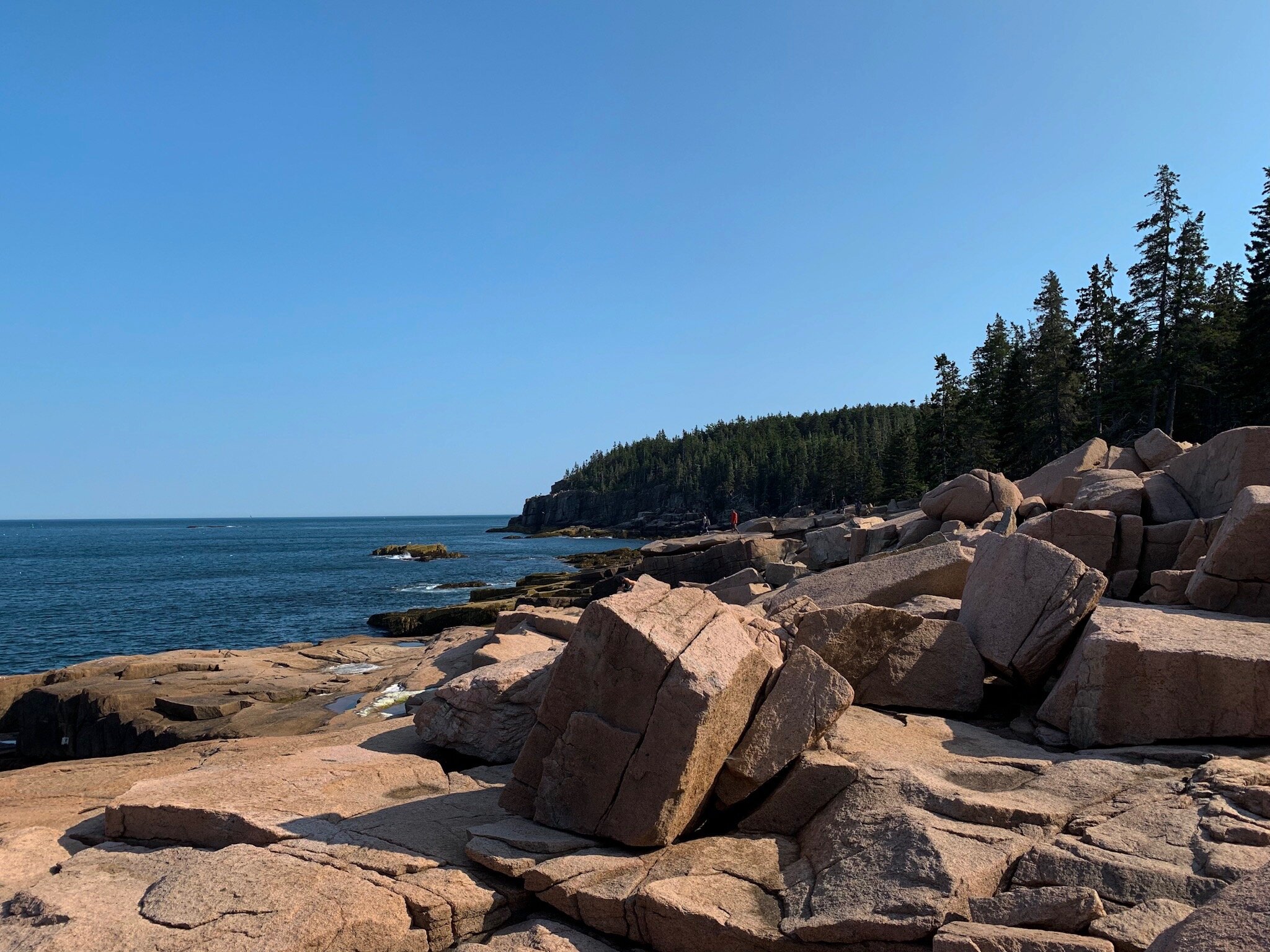
My favorite spot in Acadia National Park, ME. If you can find it, it’s yours.

My favorite spot in Acadia National Park, ME. If you can find it, it’s yours.

The East Coast is full of big cities and gorgeous landscapes. While there aren’t a lot of America’s Best Idea’s floating around back east, the ones that do call the East Coast their home are stunning, and definitely shouldn’t be missed.

To add these to a larger road trip, consider downloading my ebook: Around the States in 90 Days.

A Visitor's Guide to Olympic National Park

At the end of my 3 month solo road trip, I made a 3 day stop in Olympic National Park, Washington. The Pacific Northwest (PNW) will always have a special place in my heart. It’s the home of pine trees, mountains, and grey coastal shoreline. I first visited Washington as part of a day trip to Portland during the solar eclipse season of 2017, when I went up to Oregon for the very first time. This time, I came at Washington from the East, after visiting Glacier in Montana, and slowly made my way to Olympic about halfway through the week that I spent there.

Olympic is an incredibly unique National Park. It’s home to a vast array of different landscapes and ecosystems, and has a strange layout in terms of its road system. Olympic is known for its temperate rainforest, and is a favorite among backpackers and long distance hikers from all over.

This is my guide to Olympic National Park, and why you should add it to your bucket list.

Rialto Beach, Shore Section, Olympic National Park, WA

Rialto Beach, Shore Section, Olympic National Park, WA

Getting to Olympic

Olympic has a strange layout in that you cannot drive through the park, you can only drive around it. Of course, you can drive into certain sections, but you can’t drive straight through, so you have to be really cautious of where each entrance is. The good news is, as you drive the 101 around the park, you’ll pass through plenty of towns, such as the Twilight-famous town of Forks.

It’s important to know where the visitor centers are, and Google Maps will let you put in a specific visitor center when navigating to the park. Look for the Olympic National Park Visitor Center and Hurricane Ridge Visitor Center for information when you first enter the park. For extra information, the Hoh Rainforest Visitor Center is great but a little out of the way. You can also go to the Kaloch Ranger Station for help and the Wilderness Information Center for information regarding backcountry permits.

To enter certain parts of the park, such as Hurricane Ridge and the Hoh Rainforest, you will need to pay an entrance fee or show your interagency pass. It is $30 per car to enter, and your entrance fee at one section of the park will get you into the entire park for 7 days.

Lake Crescent, near Fairhomle Campground

Lake Crescent, near Fairhomle Campground

The different landscapes

Olympic has one of the most diverse ecosystems I’ve ever experienced in a National Park. They’ve got bears and banana slugs, beaches and rainforests. Every part of the park is something completely different, and it’s important to check out each of them. The following sections will bring you through each different ecosystem (and let you know which is my favorite!).

The Hoh Rainforest

“While there are multiple temperate rainforests in the United States, the Hoh is the only one you can drive your car into,” said a ranger at the Olympic National Park Visitor Center when I first arrived. I was immediately intrigued and set out to do my big hike through the rainforest on my second day in the park. The Hoh is known for backpackers, and has three trails. Two of them are small loops near the visitor center, but the Hoh River Trail is 17.3 miles long and is used for backpacking. You don’t have to have a permit to day hike on it though, so I went to Five Mile Island and back, making for a 10 mile hike.

The rainforest is home to lush greenery, crazy wildlife, like banana slugs and their darker, invasive species cousins, and tons of tourists. This is definitely the most popular part of the park, so plan accordingly! There is a campground in the Hoh too, just make sure you’ve got your rain fly if you’re tent camping.

Hoh River Trail, Hoh Rainforest, Olympic National Park, WA

Hoh River Trail, Hoh Rainforest, Olympic National Park, WA

Hurricane Ridge

It’s not Washington without mountains. Hurricane Ridge is the mountainous part of the park that is most easily accessible to visitors, as you can drive straight to it! It offers clear views of the park, but is pretty far from the rest of the attractions and is one of the few spots in the park that you need to pay an entrance fee for. Unfortunately, this is also one of the only parts of the park I didn’t get to explore, because it was Labor Day and the roads were too crowded for me to make the day trip.

You can camp at Hurricane Ridge, at Heart O’ the Hills Campground.

Lake Crescent

I recently talked about Lake Crescent in my Best Lakes of 2019 post, so I’ll make this short. Lake Crescent is known as one of the prettiest parts of the park. You can camp here at Fairholme Campground, which I did for 2 nights, and it was lovely. There is a nearby camp store with food, souvenirs, and other camping essentials like ice. The lake is open to boats, kayaks, SUPs, and other water recreation, and the area has plenty of hiking trails. I personally loved the Spruce Railroad Trail, which takes you through a really cool tunnel, and goes along the length of the lakeshore.

Be careful, though, this is the only part of the park that has poison ivy.

You’ll also be nearby Elwha and Sol Duc Valley when you stay near Lake Crescent and both are worth a little day trip (although Elwha is currently closed to cars).

Lake Crescent, Olympic National Park

Lake Crescent, Olympic National Park

Shore Section

All of this mountain and forest stuff is connected somehow, but on the other side of the highway you’ll find the shore section. The Olympic shoreline is easily my favorite part of Olympic National Park. It’s my Pacific Ocean that I grew up with, but it’s so different. There are pine trees overlooking the shore, and it’s full of rocky tidepools to explore.

Rialto Beach is my personal favorite, but you can also visit Kaloch and Ruby Beach and the coast near Lake Ozette. You can camp near the shore at Mora Campground (requiring reservations for 2020), and South Beach.

Rialto Beach, Olympic National Park, Shore Section

Rialto Beach, Olympic National Park, Shore Section

Truly, Olympic is the most diverse National Park I’ve been to. If you’re looking for a destination with beach, pine trees, mountains, lakes, and a little bit of rainforest (or a lot, depending on how far you hike), you won’t be disappointed with Olympic. So, make sure it’s on your list, and don’t miss the rest of the PNW while you’re at it.

If you’re interested in visiting Olympic and working it into a much larger road trip, check out my ebook: Around the States in 90 Days.

Your Guide to Crater Lake National Park

When I was traveling through the continental 48 during the summer of 2019, Crater Lake was the last stop before I touched ground back in my home state of California. Now, I’ve mentioned Crater Lake in plenty of blog posts so far (here, here, and here), but I’ve also gotten a couple questions asking for more information about actually visiting the park.

Note: this post may contain affiliate links

Now, Crater Lake is the only National Park in Oregon, and it’s one of the smallest big parks in the country. I tend to categorize the parks into “small” and “big” parks, the big parks being the ones with an entry gate, possible campgrounds, and use the America the Beautiful Pass. Crater Lake, while it is smaller in acreage, contains about 30 miles of the Pacific Crest Trail, a dormant volcano, and the deepest lake in the country.

These are my tips and tricks for getting the most out of your trip to Crater Lake. So, grab your 0 degree sleeping bag (it’s cold out there!), some yummy snacks, and a park map, and let’s explore one of the most unique locations in the country.

View of Wizard Island from Sun Notch

View of Wizard Island from Sun Notch

Getting there

Crater Lake is located about an hour and a half south of Bend, OR. You’ll drive through some of the most beautiful forests to get there, no matter which entrance you come in through. When you arrive, you will be met with that classic entrance gate. Without the America the Beautiful Pass, park entry costs $25 per car.

Phantom Ship, as seen from Sun Notch

Phantom Ship, as seen from Sun Notch

About the park

Crater Lake is the ninth deepest lake in the world, and the deepest in the United States. Because of this, it has a beautiful deep blue color to it. Crater Lake is one of the many volcanic parks in the country, and is also home to an unexpected crop of pinnacles formed by lava flow.

While the park is open year-round, during the winter months, the road is closed to cars. Yearly, the park receives over 500 inches of snow, and the best months to go are July, August, and September. The park is never very warm though, the highest average temperature only reaching 80 degrees Fahrenheit, and dropping into the 40s at night. Because of this, it’s incredibly crucial to have the right gear, and a 0 degree sleeping bag just in case, even if you’re camping in your vehicle or RV. (I highly recommend the sleeping bags available from Madera Outdoor—they’re warm, lightweight, vegan, and you’ll receive 20% off your order.)

There is a scenic loop road that will bring you all around the lake and park in the summer months. The 33 mile long road will bring you to all of the 30 overlooks, as well as the park’s hikes, except those located on the offshoot that is Pinnacles Road. Pinnacles Road is where you can find a small waterfall hike called Plakni Falls as well as the Pinnacles Trail, which has one of the most unique views in the park. Here, you’ll also find the park’s dry campground, Lost Creek.

The strange Pinnacles area of Crater Lake National Park

The strange Pinnacles area of Crater Lake National Park

Staying in the park

There are two campgrounds in the park, and I actually highly recommend staying in Lost Creek campground, even for vanlifers. The campground is only $5, and you’ll get the extra security of being in the park (always a plus for solo female travelers), as well as the convenience of not having to leave. It does not take reservations, and did not have running water during summer of 2019.

The other campground is called Mazama, and is located near Rim Village, which give you close access to the visitor center, clean water, gift shop, and in-park gas station. It costs between $21 and $43 to camp here, so I’d recommend this for families and tourists, rather than overlanders. All campsites in the park, including those at Lost Creek come with a bear locker.

There is also lodging available in the park. As with all national parks, I’d recommend booking your lodging (or even camping) reservations a few months in advance through the park’s official website and whatever reservation system they have set up. There are two motels available in Crater Lake: Crater Lake Lodge ($202 per night), and The Cabins at Mazama Village ($164 per night).

You can also eat at the restaurant in the park, which is called the Rim Village Café, and buy groceries and snacks at the Mazama Village Store. The Crater Lake Lodge also offers a dining experience inside the park.

Plaikni Falls

Plaikni Falls

Hiking in Crater Lake

I constantly heard that Crater Lake isn’t worth spending more than a day in because all the hikes are the same, which is simply not true! There are tons of little hikes to do, which are great for families and beginner level hikers that will take you to places like waterfalls (Plaikni Falls), the unique pinnacles (Pinnacles Trail), and views of the lake and it’s famous Wizard Island and Phantom Ship (Sun Notch).

There are longer hikes in the park perfect for moderate to advanced hikers. Fantastic moderate hikes are Watchman Peak and Discovery Point, which both offer amazing scenic panoramic views of the lake.

For my advanced hikers, the best hike you can do is Cleetwood Cove. This is the only legal access to the water in Crater Lake National Park. Here, you can swim, take boat tours, or just relax by the water. Other amazing advanced hikes are Wizard Summit (trailhead only accessible by boat), and Mount Scott (the park’s highest point).

Crater Lake is beautiful, even on a cloudy day

Crater Lake is beautiful, even on a cloudy day

Crater Lake truly is one of the most unique landscapes in the country that I’ve personally visited (so far). While it’s very cold, and a smaller park, its beauty is unmatched by any of the country’s other famous lakes. From camping to hiking to simply being an amazing vacation spot, Crater Lake has something for every type of traveler to experience, and is sure to help you appreciate the outdoors just a little bit more.


To read more about Crater Lake and many of the other national parks in the country, check out my ebook: Around the States in 90 Days in the shop!

Your Guide to Carlsbad Caverns National Park

Carlsbad Caverns is one of my favorite southern national parks. Located in Southern New Mexico, just minutes from the Texan state line, Carlsbad Caverns is found in the Chihuahuan Desert, and was formed by sulfuric acid and limestone.

This is a small park, and it doesn’t have a campground. Because of that, there are only a couple things to do in the park, but that doesn’t make them any less spectacular.

Carlsbad Caverns is home to two of the most unique experiences I’ve had in national parks, and I’ve been to 33 of them. I went with my family during the section of my summer trip that they met up with me for, and we stayed in Carlsbad at a nearby hotel. This was my dad’s second time in the park, and the good news is, it hasn’t really changed much, so let’s head out, and explore what Carlsbad Caverns has to offer.

Inside the cave!

Inside the cave!

Camping

As I said before, Carlsbad Caverns doesn’t offer a campground inside the park. The good news is, one of its nearby parks does offer camping in an amazing little campground near the tallest peak in Texas—Guadelupe Mountains National Park. Camping here is $15 and you’ll have easy access to all of this park’s trails as well.

Tips for visiting

Carlsbad Caverns is one of the most accessible national parks for tourists. There are a lot of parks that require hiking in order to see the park’s beauty, but in Carlsbad Caverns, you’ll be able to experience everything this park has to offer on its paved walking trail.

While this park doesn’t require an admission fee, you do need to pay to enter the cave. Because of this, I highly recommend investing in an America the Beautiful Pass, Military, or Senior interagency pass for your admission, especially if you plan on camping in Guadelupe Mountains and visiting any other national parks in the country within the same year. Without a pass, everyone over age 16 is $15 for entry, but the pass will get a family of 4 in for free.

Sunset from the visitor center in Carlsbad Caverns National Park

Sunset from the visitor center in Carlsbad Caverns National Park

Seeing the cave

I’ve visited a few caves around the country, and while Carlsbad Caverns isn’t the largest (Mammoth Cave, KY is), it’s definitely the most spectacular (in my opinion). There are two ways to enter the cave. If you’re not a hiker, I’d highly suggest taking the elevator. It’s a 700 foot journey into the earth, and you’ll be able to take your time exploring the cave’s paved path by foot. If you want to hike in, that is also an option, but know that the cutoff for admission to hike is 5 pm MST in the summer.

When in the cave, please stay on the paved path, and don’t touch the cave!

Ranger-led tours

If you want a more immersive experience when it comes to viewing the cave, you can sign up for a ranger-led tour. You can reserve your spot on a tour through the Carlsbad Caverns official website. Tours will take you through different areas of the cave, depending on how involved of a tour you want to do, and tours cost between $7 and $20 without a senior access pass.

The bat flight program

Every night at sundown, people gather in the park’s amphitheater to watch the bats leave the cave. This event is actually the way that Carlsbad Caverns was discovered in the first place. Around exactly the same time every night, the bats leave the cave to feed for the night, and it’s a spectacular sight you don’t want to miss.

Tip: bring food into the park. The park restaurant closes at 6 in the summer, but the bats don’t leave the cave until 8, so you might get hungry while you wait.

The view of the New Mexico desert from the visitor center

The view of the New Mexico desert from the visitor center

Carlsbad Caverns is a fantastic small national park. There isn’t a ton to do, but what there is to do is absolutely mind-blowing. If you’ve never seen a cave, this is a great place to start, but be warned, this one will raise your expectations for all caves you’ll visit after.

Another place to add to your list: MAMMOTH CAVE NATIONAL PARK

Mammoth Cave has over 600 miles of explored cave in the middle of Kentucky. It is the largest cave yet to be discovered in the world, and is free to enter the park. The cave is $6 to enter, and there is camping available in the park.


To visit Carlsbad Caverns, Mammoth Cave, and more, check out my ebook, Around the States in 90 Days!

My 2020 Travel Resolutions

It’s that time of year again, and I’ve always been a sucker for New Year’s Resolutions. There’s something about the end of the year, the closing of a new chapter, even though of course, it’s just an arbitrary line time that doesn’t actually mean anything at all. But that doesn’t stop us from making a list of goals for the new year, every year.

2020 is going to be a huge travel year for me, and not just because I’ll be officially starting my full time vanlife journey.

I start my year in Thailand, and almost immediately fly to my first new country of 2020: Laos, all part of a huge volunteer excursion. Now, I think travel is the perfect way to start my year, as a jump start toward all of the other travel goals I have for the year. I’m a person of lists and goals because once I make a goal for myself, I have to figure out a way to make it happen.

These are all of the travel goals I have for 2020 (so far).

One of my favorite California National Parks, Yosemite. Here’s to crossing off those last 3!

One of my favorite California National Parks, Yosemite. Here’s to crossing off those last 3!

1: Finish crossing off the rest of the California National Parks

California is my home state, and it’s also the state in the country that has the most national parks. It has nine, and I’ve been to 6 so far. The three I have left have felt a little inaccessible to me for a few reasons, but I think with the van it’ll definitely be possible to finally make the trips.

The ones I have left are Channel Islands, Death Valley, and Lassen Volcanic.

Now, with Lassen Volcanic, I have no excuses. I chose to skip this one on my summer road trip because I was homesick and being back in California made me want to head south, not east. I will 100% find my way here in 2020.

Death Valley is a little intimidating to me because it’s the largest national park in the continental 48. This means I’ll definitely have to carry extra gas, oil, and other fluids my old van might need, as well as jumper cables. Death Valley seems like a magical desert to me, and I’m super drawn to the salt flats, so I think I have to finally make my way there, especially because it’s only 3 hours from my home city. It would take a lot of stress off if I could caravan with someone so that if one vehicle has issues, the other can make the drive to get help.

Channel Islands is a tricky one because you can’t drive there. I’m a plan-as-I-go type of traveler, and you have to reserve ferry tickets ahead of time. The ferries also aren’t run by the NPS, so my annual pass won’t really help me out when it comes to admission here. But I also have no excuse because the harbor is less than an hour from my home base.

More California beauty! Can’t wait to get back to NorCal to explore Lassen…

More California beauty! Can’t wait to get back to NorCal to explore Lassen…

2: Visit three places that are completely new to me

This one goes a bit bigger than the national parks, for this little category, I’d like to cross off three big places that are new to me, meaning countries or states. Now, I only have one more state to cross off, and that’s Alaska. I’m desperately trying to figure out a way to make it up there in my van, but it honestly scares me to the point where I know I definitely want a travel or caravan buddy for this one.

Other places that are in the works for 2020 are Laos (100% happening, I will be flying there from Thailand in early January), and potentially Canada and Israel.

3: Cross off five national parks that are not in California

I’ve visited 33 US national parks so far, but surprisingly, this is only a little more than half of the ones out there. I’d love to visit at least five new national parks in states other than my own. I’m thinking the Southwest seems promising (think, Saguaro, Petrified Forest, Zion, Canyonlands, Capitol Reef, Arches…), but this could definitely fit in with goal #2 if I make it to Alaska, since I will be visiting the three you can drive to up there, if I make it (Denali, Kenai Fjords, and Wrangell St. Elias).

Me, last time I was in Utah. The Southwest is definitely calling my name…

Me, last time I was in Utah. The Southwest is definitely calling my name…

4: Pick a destination completely at random

Since I travel full time, I thought it might be cool to figure out a new way to pick a place rather than planning. I’m such a planner when it comes to the destinations I want to visit along a big trip, so I’d love to see what magic could come my way from selecting a spot at random to explore. I want to bring more spontaneity into my larger trips but because I love the planning stage so much, there’s usually little room for this. I think this might be a cool way to attract it into my life and travels.

5: Experience something completely out of my comfort zone

I’m not quite sure what this means yet, because as with anyone, it takes a bit of soul-searching to figure out what exactly that comfort zone is. This could 100% fall into the category of one of these other travel goals, or it could be something as huge like taking that leap and going to Alaska or something super small trying a strange and new food I’ve never heard of (vegan, of course).

It’s all about seeing where the journey takes me.

Special bonus goal number 6: Travel full time and have Halle’s Wandering Soul fuel my adventures

This one is entirely based on you guys. I do work online, and this is one of my many hustles, but I’d absolutely love for it to be a little more than just a hustle. I plan on putting out some insane content this year, on here, on Youtube, on Instagram, on all of my platforms. But this all depends on you guys, so share my posts, click through, watch the Youtube videos, tell your friends about this crazy solo female vanlife journey I’m on, and get people excited about changing their lives through travel. My goal is to inspire you, and making that difference in more people’s lives is a huge goal of mine.

(If you’re also interested in learning to make money online and change your life in 2020, click HERE!)

Acadia National Park was a place that pushed the boundaries of my comfort zone. It was where I first let vanlife into my life and started camping for free at night, and the place I first tried bouldering.

Acadia National Park was a place that pushed the boundaries of my comfort zone. It was where I first let vanlife into my life and started camping for free at night, and the place I first tried bouldering.

This upcoming year, I think we’ve all got a lot to look forward to. And the thing is, it’s all about manifesting them into existence rather than just waiting for them to happen on their own. If you want something, or want to visit somewhere, or want to actually get traveling, tell yourself it’s going to happen, and then make it happen!

I’d love to hear your 2020 travel goals. Leave them in the post comments, or, if you share this post, add your goals to your share and tag me @halleswanderingsoul (on Instagram and Facebook, and @hallewanders on Twitter, in an actual post, not your story because I’m currently out of the country and won’t see your post for a little bit!).

To help inspire your 2020, head over to the shop to find some pre-made trip itineraries just ready to inspire you! Use them to plan your next little trip, or your first huge trip! Go with a partner, go with a pet, or go solo. It doesn’t matter, as long as you go where your heart is leading you. Happy New Year, everyone, safe travels.

-HWS

My Favorite Destinations of 2019

And why they should be on your list for 2020

It’s no secret that I traveled a lot in 2019. I visited all 48 connecting states, 29 national parks (some more than once), and I’ll be ending my year in Southeast Asia. So many of these places made a huge impact on me as a traveler, a writer, and a solo person, but only a few can count as my favorites. Those places left a mark on me that I will never be able to shake, and I think I’ll spend my entire life trying to return to them as many times as I possibly can. This is a list of my absolutely favorite spots I visited during 2019, and why you should add them to your 2020 bucket list.

4: Acadia National Park, Maine

Acadia instantly drew me in as I drove around its loop road for the first time. Before visiting Acadia, I had no idea that you could experience pine trees and ocean in one spot, an experience I only ever saw here and in Olympic, WA. Acadia was also a bit of a sentimental stop for me, since it marked the halfway point in my trip around the country. Acadia is an absolutely mind-blowing place. It’s so unique in its landscape, is home to some crazy wildlife, and it’s one of the northernmost national parks in the continental US.

Why it should be on your 2020 bucket list:

Acadia is an absolutely beautiful spot that isn’t too crowded with tourists right now. It’s amazing for overlanders, since it’s nearby one of my favorite free camp spots I’ve ever stayed at, and has a little something for every type of traveler, from tourists who just want to drive the gorgeous road and look at the views, to climbers who want to do some crazy bouldering, to hikers who want to climb a mountain. There’s even a beach in the park that leads you to the Atlantic Ocean.

Acadia National Park, ME

Acadia National Park, ME

3: Devils Tower, Wyoming

Devils Tower is one of the most unique things this country’s landscape has to offer. Devils Tower was formed by what used to be a volcano, and is now a sacred place for Native Americans and a popular climbing spot (just make sure you get your permit first!). Devils Tower is located in the American Grasslands, and is home to wildlife such as prairie dogs. The park contains about 8 miles worth of hiking trails and plenty of opportunities to view the tower.

Why it should be on your 2020 bucket list:

Devils Tower is definitely living in the shadow of its Wyoming brother and sister: Yellowstone and the Tetons. It’s a smaller park, but it’s so unique compared to the rest of this country’s landscapes. Don’t miss an opportunity to experience it, especially now that the prairie dog populations are doing really well.

Check out my free guide to Devils Tower!

Devils Tower, Wyoming

Devils Tower, Wyoming

2: The Grand Canyon, Arizona

The Grand Canyon is one of those places you have to see at some point in your life. It’s incredibly vast, and has far more to offer than many people think. I had some incredible wildlife encounters here, and completed one of my favorite hikes I’ve ever done, the South Kaibab Trail. The Grand Canyon is so much more than people give it credit for because of its popularity with tourists, and honestly, was an emotional experience. I’d dreamed of seeing the Grand Canyon for a long time, which is part of the reason it was the site of my first solo trip, all the way back in March. Regardless of emotional attachment though, make sure you visit, especially if you’ve never been to Arizona.

Why it should be on your 2020 bucket list:

The Grand Canyon is just going to get more crowded as travel becomes more accessible. Make sure you see it before it’s completely crowded with tourists, and, who am I kidding? It’s the Grand Canyon! If you haven’t seen it yet, you need to. I promise it’s more than you think.

Access my free guide to the Grand Canyon HERE!

View from Mather Point in the Grand Canyon, Arizona

View from Mather Point in the Grand Canyon, Arizona

1: Glacier National Park, Montana

Glacier is hands down my favorite place on Earth right now. From the towering mountains, wildlife you can’t find anywhere else, perfect campground, and of course, glaciers, Glacier National Park is popular for a reason. This is one of the largest national parks I’ve been to, and also one of the most popular. It’s located right on the Canadian border, and no matter where you go, the views are more than you could have ever dreamed them to be. Here, you can spot waterfalls, mountain goats, and grizzly bears, and complete my favorite hike in the world, Grinnell Glacier. (Tip: Many Glacier, where the hike is located will be under construction in 2020, so make sure you plan accordingly)

Why it should be on your 2020 bucket list:

Let’s face it, Glacier’s glaciers are melting. The sooner you make time to go see them, the better. Right now, there was still ice in August, but as the years go on, the amount of glaciers in the park is dwindling, so make sure you see them before it’s too late.

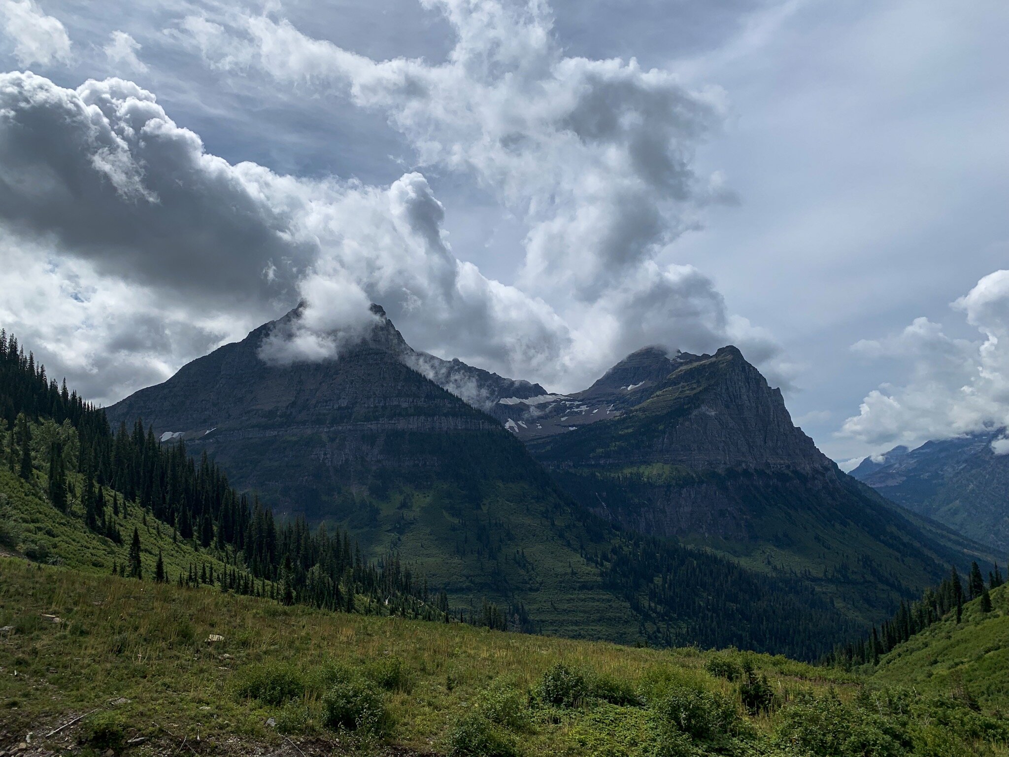
View from the High Line Trail in Glacier National Park, Montana

View from the High Line Trail in Glacier National Park, Montana

2019 was a game-changing year for me in terms of travel. I visited some of the most beautiful places in the United States, and its inspired me to expand and maybe cross some borders next year, in 2020. Tune in next week to hear my 2020 travel goals, and get inspired to add to your own list in this new decade!

To help you start planning an epic 2020 trip, check out my ebook: Around the States in 90 Days.

A Complete Guide to Visiting the Grand Canyon

The Grand Canyon is among my favorite places on Earth. It was the site of my first ever solo trip, and will forever hold a special place in my heart. Located in Northern Arizona, the Grand Canyon is one of the Earth’s natural wonders, but it’s far more than just a hole in the ground.

At the bottom of the canyon is the Colorado River, flowing between the two main rims of the canyon. The Grand Canyon is home to a huge amount of wildlife, from elk to marmots to California condors, and it is the second most visited national park in the country.

I visited the Grand Canyon solo for three days during my last ever spring break. This was not only the perfect place for a solo trip due to the fact that it feels incredibly touristy and safe, but it was an absolutely beautiful place to visit alone. Being solo for this trip allowed me to really take it in, and this is a place you really have to be present for.

Being alone also allowed me to see most of the South Rim while I was there, which is the most popular section of the park to visit. This is your guide for planning your own trip.

Note: this post may contain affiliate links

View from the South Rim in March

View from the South Rim in March

So… there’s more than one rim?

Yes! The two main sections of the park are the North Rim and the South Rim. The South Rim is open year-round, and is located, well, further south, which means it’s a little warmer. The North Rim closes in the winter months and off season because it’s located at a higher elevation, and generally reopens in May. This elevation difference is so great, I’ve heard stories of people waking up to snow in the summer!

Most of this article will be about the South Rim, as it’s far easier to access for tourists.

Canyon wall on the South Kaibab Trail

Canyon wall on the South Kaibab Trail

Getting to the park

The South Rim is incredibly easy to access. It has that classic “pay at the gate” type of entrance most large national parks have ($35 to enter, or America the Beautiful or other interagency pass). The closest town to the South Rim is Tusayan, and if you don’t want to drive, you can park your car in town and shuttle into the park (highly recommended during busy weeks, such as holidays and spring break).

I hear a lot of questions about visiting the Grand Canyon from Vegas, and I just want to put it in here that the South Rim is a 5 hour drive from Vegas. It is not super accessible. You can visit the West Rim, which is not part of the national park, and is home to the glass Grand Canyon skywalk. This is a cool thing to do, but it is not the national park, and will not give you that classic experience.

View as you approach Skeleton Point on the South Kaibab Trail

View as you approach Skeleton Point on the South Kaibab Trail

Staying in (or near) the park

I’m a traveler who prefers campgrounds, so when I visited, I stayed in Mather Campground because it was the only one of the two on the South Rim that was open in March (yes, March is still considered winter!). I reserved my site 3 months in advance (during that good ol’ government shutdown, remember that?), so I’d recommend booking a site as soon as you decide you want to camp in the park. Hopefully, you’ll be greeted by a herd of elk, like I was (which you can see in THIS VIDEO)—just make sure you give them their space! There is also a hotel in the park, and a second campground open during peak season (summer months) called Desert View.

There is also a campground in the North Rim if you choose to experience the northern side of the park. It is called North Rim Campground and is first come first served ONLY for 2020.

If you can’t book a spot in the park, no worries! Like I mentioned before, the town of Tusayan is an awesome place to stay because you can shuttle into the park from your hotel. The town of Williams is about a 45 minute drive from the park, which also has plenty of hotel and Airbnb options.

Marmot hanging out next to Skeleton Point

Marmot hanging out next to Skeleton Point

What is there to do?

I’ve heard tons of people say that they’ve gotten bored at the Grand Canyon, but the truth is, there is so much to see and do! If you’re not a hiker, there are plenty of sightseeing areas to explore.

You can walk part of the Rim Trail, which is a flat, 13 mile long stretch with views from the top of the South Rim. Most people only do a couple miles and stop at various viewpoints. A great place to start is behind the visitor center, at Mather Point (different from Mather Campground). Here, you’ll get some of the best views from the South Rim.

It’s also always useful to make a stop at the visitor center. This is where you can get all of your questions answered and explore the museum to learn more about the park. Here is also where you can find out information about various ranger programs.

Other great viewpoints work seeing are Yaki Point (known for being a great spot to view the sunset), and Yavapai Point (accessible from the Rim Trail).

It seems to just go on forever…

It seems to just go on forever…

I’m a hiker, where should I go?

The Grand Canyon is huge for hiking. While there are trails rated difficult on both rims, the most famous trails in the park are Bright Angel and South Kaibab (there is also the North Kaibab Trail on the North Rim). Both trails go to the bottom of the canyon, but you cannot go to the bottom without a backcountry permit.

The difference between the two is that Bright Angel is longer, but not as steep, which makes it the more popular of the two trails. South Kaibab is far steeper, but also far less crowded. I did a bit of Bright Angel on my first day in the park, but it was a bit too crowded for my liking. The next day I took the shuttle to South Kaibab (there is no parking lot—you have to shuttle), and it was far more enjoyable.

There are three stops before the river on the South Kaibab Trail: Ooh Ahh Point (great for families with kids), Cedar Ridge (perfect for moderate level hikers), and Skeleton Point (awesome for advanced day hikers). There is a similar set of rest stops along Bright Angel: Mile and a Half Rest House, Three Mile Rest House, and Indian Garden. Both big trails are out and back trails, and you will have to hike up the way you came, so bring water and plenty of food and plan accordingly.

Crazy rock formations out here

Crazy rock formations out here

Phantom Ranch and Havasupai

If you’re at all on Instagram, you’ve heard of Havasupai: the famous blue waterfall in the Grand Canyon. And if you’re into hiking, you might’ve heard about Phantom Ranch and Phantom Campground. Both spots require a backpacking permit to visit, and permits to Havasupai are growing more and more difficult to get (and cost $150 per night per person). Please do not attempt these hikes without proper training and a permit.

While we’re on the topic of backpacking, it is also possible to hike from the South Rim to the North Rim, but you also need a permit to accomplish this. If you do plan on backpacking, please make sure you have the right gear, and a cold weather sleeping bag made for backpacking.

View from Mather Point

View from Mather Point

Anything else?

Of course, there’s so much more to experience, but these are the most notable, and with this information under your belt, you’ll be more than prepared for a trip to GCNP. The most important thing is to respect wildlife. Especially when larger wildlife like elk are present, it’s necessary to keep the Leave No Trace principles in mind and stay 25 yards away!

But above all, have fun! If you’re camping, make sure you have the right gear and you’ll have the best time—camping in the Grand Canyon is one of my favorite camping experiences. Make sure you carry water, but also carry a camera: this park will not fail to blow you away.

Leave your questions about the park below! I’d love to hear from you!

A Quick Guide to Devils Tower National Monument

I’ve written about Devils Tower quite a few times now, so it’s clear that it’s one of my favorite spots in the continental United States. It’s also one of the most unique landscapes I’ve experienced, and is home to one of the most popular and challenging climbing spots in the country. Devils Tower was the first National Monument in the United States, and is located in Eastern Wyoming.

The tower itself is actually the remains of what used to be a volcano, and the area surrounding it is considered sacred by the Native American tribes in the area. When visiting, please respect prayer flags you might see hanging on trees and appreciate their unique beauty.

Devils Tower doesn’t just have cultural and geologic history, it’s also a huge piece of pop cultural history. Devils Tower was a major part of the set and story in Stephen Spielberg’s Close Encounters of the Third Kind, and because of that, many of the surrounding souvenir shops sell alien themed gifts.

Devils Tower is run by the National Park Service, but it is not a National Park. Despite the fact that it’s been a National Monument since 1906, it hasn’t received that legendary upgrade. A lot of people say that this is because the park itself is so small, but in my opinion, the tower itself is so magnificent, it deserves park status.

Note: this post may contain affiliate links

DevilsTower2.JPG

Preparing for your visit: things to know

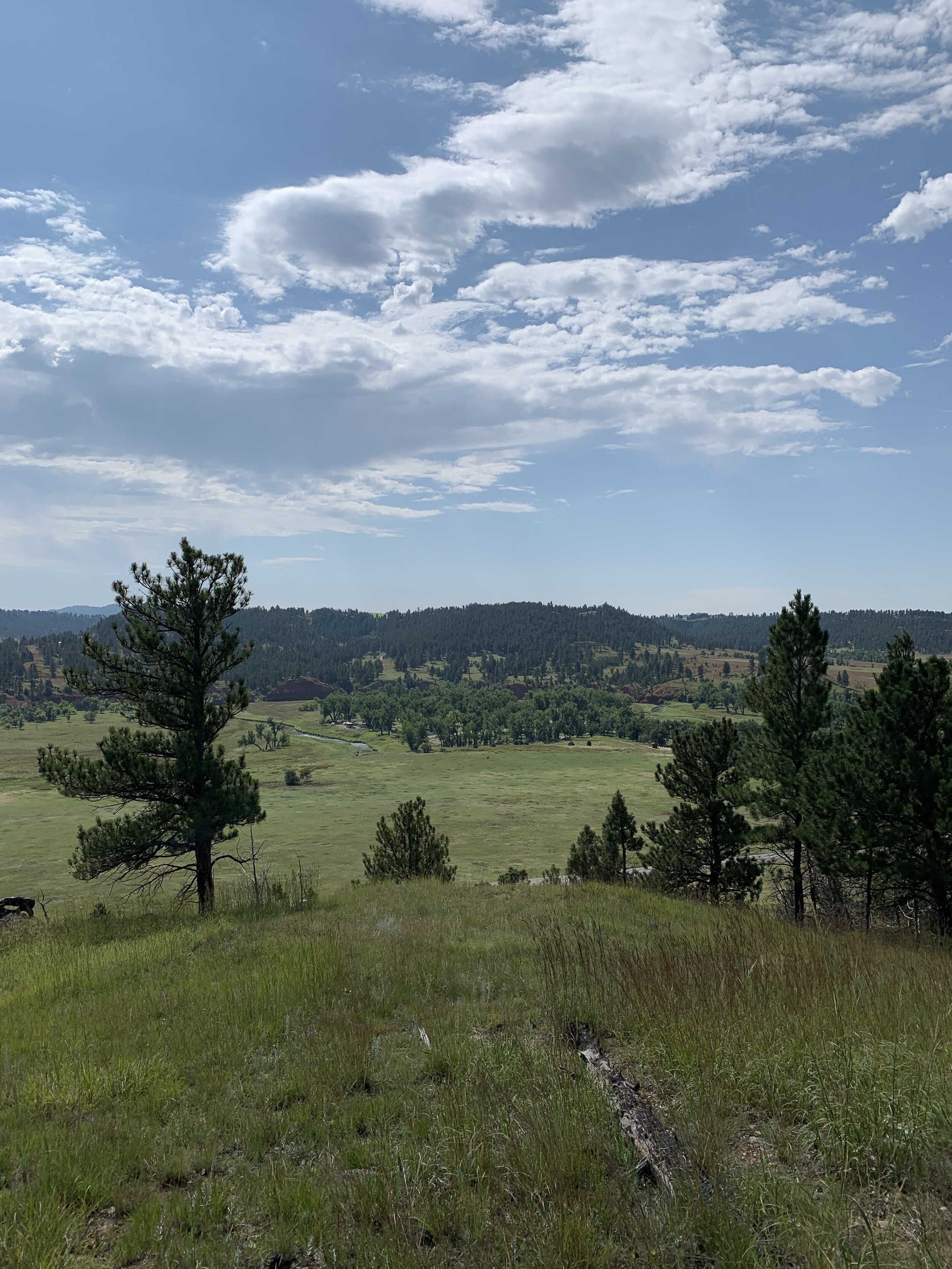
Although Devils Tower is an incredibly small park, it’s absolutely magnificent. The road through the park is very short—only about 6 miles long from the entrance gate to the visitor center, and there is only one entrance. Regardless, the drive will take you past gorgeous red rocks, a prairie dog town, the park’s campground, and through gorgeous pine forests before you get up close and personal with the tower.

Entrance to the park is $25 or an interagency pass. You can either enter the park coming from Sundance or Hulett, but again, there is only one entrance, so it just depends on which direction you’re coming from. Hulett, which is about 10 miles from the park, has the closest gas station, but just outside the park, there are other services at the KOA (grocery and souvenirs), and the other souvenir shop across the street, which has WiFi. Having access to WiFi while I was there was a huge life saver for me, since I work online. This makes Devils Tower rank high for me in terms of accessibility to full time travelers. (If you’re trying to get on the road full time, or simply want to learn different ways to make money online, check out Wired Creatives HERE).

The visitor center will be your best friend while you’re here. The rangers are super helpful, and there is plenty of parking, including parking for larger vehicles and RV’s. The visitor center is the closest you can get to the tower without climbing it, and is the site of the Tower Loop Trail, a paved trail that I’ll get into more detail about in a couple sections.

DevilsTower1.JPG

Staying in or near the park

There really are only two options for a stay at Devil’s Tower. My personal preference is to stay in the park. I stayed at Belle Fourche Campground, which had amazing views of the tower from site A12, and cost $20 per night. The campground had picnic tables, flush toilets, and clean water for drinking. Plus, there’s the added safety of being inside the park, which is a huge plus when you’re a solo female traveler. The campground got strong AT&T service, which was also a plus because I didn’t have to go totally off the grid while I was there. If you stay in Belle Fourche, make sure you go to a ranger program or two—they’re super fun, and you can see climbers descending the tower at night from the amphitheater.

The other option is to stay at the KOA. Here, you’ll have more options for accommodations, from electric hookup sites for RV’s to little cabins if you’re not into camping. The KOA is much more expensive, and comes with a wider range of amenities.

Sunset over Devils Tower from my campsite in Belle Fourche Campground

Sunset over Devils Tower from my campsite in Belle Fourche Campground

Hiking Devils Tower

While Devils Tower is incredibly accessible to all kinds of tourists, you can easily see all of the easy-to-reach places in one day. These include seeing the prairie dog town, hitting the visitor center, and walking the Tower Loop Trail, a paved trail that circumnavigates the tower. Rock climbing is also popular here, but it’s not recommended unless you’re an advanced climber. You can also work the Tower Loop Trail into a much longer day hike, which I’ll get into in a second.

You can easily just do one of the few trails in the park, but none of the single trails are very long at all. Instead, since I’m an experienced hiker, it was recommended to me to do the “Devils Tower Marathon,” which connects all of the 8 miles of trails into one big hike. To do this, you’ll start by driving up a dirt road that’s near the visitor center to the Joyner Ridge Trail. From there, you’ll take a connector trail to the first half of the Red Beds Trail. From Red Beds, you can either cross the road and do the Valley View trail, which will take you near the prairie dog town. I opted out of this section because it was very overgrown and ticks and stinging nettles are a real thing. Instead, I just continued on the Red Beds Trail until I reached the visitor center, where I did the Tower Loop Trail before finishing the Red Beds Trail. Red Beds ends back at the connector trail, where you can go back and finish the Joyner Ridge Trail. This hike is between 6.5 and 8 miles total, depending on how many sections you complete.

View from the Red Beds Trail

View from the Red Beds Trail

Devils Tower is a unique experience everyone should have at least once in their life. It was an unexpected adventure for me, and I think it will forever be one of my favorite places in the country. From its cultural and pop cultural history, to its trails and wildlife, there’s so much to see here, and it should definitely be on your list for 2020, or any future year after that.

To add Devils Tower into a much longer US road trip, check out my ebook, Around the States in 90 Days.

A Guide to the Most Famous Mountain Ranges in the Continental US

It’s no secret that mountains are my favorite landscape. I’ve traveled the entire continental 48 and visited the most famous mountain ranges in the country (minus Alaska). For people who are new to the outdoors, learning the country’s geography can be confusing, especially because some of these mountain ranges are absolutely huge, stretching into Canada at times.

This is my quick guide to the four most famous mountain ranges in the US. You might’ve heard of them, and if you haven’t, you’ll be adding them to your list by the time you’re finished reading.

Note: this post may contain affiliate links

Glacier National Park, part of the Rocky Mountains, located in Montana

Glacier National Park, part of the Rocky Mountains, located in Montana

The Cascade Mountains

The Cascades is one of the bigger mountain ranges in the country, stretching from Northern California to British Columbia, Canada. Many of the western mountain ranges include volcanoes, and the Cascades are no exception. The Cascades are home to famous mountains such as Washington’s Mount Rainier and Oregon’s Mount Hood. The Cascades also include North Cascades National Park in northern Washington, a national park interspersed with forest land, and one of the most dog friendly parks in the country.

I love the Cascade Range. It’s full of incredible views and is located in what I would consider one of the best regions of the United States, the Pacific Northwest. It’s home to some of the most challenging, as well as some of the most beautiful hikes I’ve ever completed, and I definitely plan on returning in 2020. I highly suggest having some good gear for your time in the Cascades, and don’t attempt any hikes you don’t know for sure you’re prepared for.

North Cascades National Park, part of the Cascade Mountain Range, located in Washington

North Cascades National Park, part of the Cascade Mountain Range, located in Washington

The Sierra Nevadas

I’ve visited the Sierras a few times, during small trips to Sequoia and Kings Canyon National Parks, two national parks connected by a road through forest land, as well as larger trips to Yosemite. And no matter what time of year you visit, they’re absolutely beautiful, and are home to the tallest mountain in the continental 48: Mount Whitney, which stands at 14,505 feet tall.

The Sierra Nevadas stretch horizontally across the states, rather than vertically like the other ranges on this list, and lie between California’s Central Valley and the Great Basin in Nevada, although most of the mountain range is located in California. It includes both Sequoia and Kings Canyon National Parks, the Sequoia National Forest, the Inyo National Forest, Devils Postpile National Monument, and the famous Yosemite National Park.

Half Dome in Yosemite National Park, part of the Sierra Nevadas, located in California

Half Dome in Yosemite National Park, part of the Sierra Nevadas, located in California

The Appalachian Mountains

The most famous mountain range east of the Mississippi, the Appalachian Mountains stretch across the eastern United States. The Appalachians are home to one of the most famous thu-hikes in the country: the Appalachian Trail, and include famous spots such as Great Smoky Mountains National Park (the most visited National Park in the country), and the Blue Ridge Mountains. While these mountains don’t quite reach the heights that the other ranges on this list do, they once did, but due to their age, have eroded. Now, the highest point in the Appalachians lies at only 6,683 feet.

The Appalachians are absolutely gorgeous. I’ve done some absolutely beautiful hiking there, in the Smokies and in Shenandoah National Park. While they aren’t as tall as my mountains out west, they’re often far greener than anything I’m used to seeing due to the amount of rain they get back east.

The Great Smoky Mountains, part of the Appalachian Mountains, located in Tennessee and North Carolina

The Great Smoky Mountains, part of the Appalachian Mountains, located in Tennessee and North Carolina

The Rockies

The Rocky Mountain Range is one of the largest mountain ranges in the area, stretching from Canada all the way to New Mexico. Of course, the most famous spot in the Rockies is Rocky Mountains National Park in Colorado, which is why we often refer to the part of the Rockies located in the states as the “Colorado Rockies.” You’ll be surprised to find out, though, that some of the other famous mountains in the middle of the country are actually part of the Rockies as well, including the Grand Tetons and Glacier National Park.

The Rockies are home to some of the biggest and most beautiful mountains I’ve ever seen. Most parts of them are extremely cold due to their elevation, the tallest mountain in the range being Mount Elbert in Colorado, standing at 14,440 feet. Apart from tall mountains, I’ve seen some of the most incredible wildlife in the Rockies, from mountain goats, grizzly bears, and big horned sheep in Glacier to elk and deer in Colorado’s Rocky Mountains National Park.

(When hiking in these areas, please carry bear spray, especially if you’re hiking solo. I never once felt that I was in danger, but it’s always good to be prepared for anything.)

The Grand Tetons, part of the Rocky Mountains, located in Wyoming

The Grand Tetons, part of the Rocky Mountains, located in Wyoming

Of course, there are plenty of other, smaller mountain ranges in the country, and a few I haven’t explored yet, up in Alaska, but if you’re starting to plan your trip around the US, these are four sections of the country you definitely can’t pass up, especially if you’re a hiker, camper, or general lover of the outdoors. These mountains have left a mark on me as a traveler, and I can’t wait to return to them in the future.

Which one is on the top of your 2020 bucket list? Let me know in the comments!


If you’re planning a 2020 (or whenever!) trip around the US and want to include all four of these beautiful places, my ebook, Around the States in 90 Days will be a great resource for you. Check it out in the shop!